
map
Showing 235–273 of 365 results
-
![Norris' Map of the United States of America together with adjacent portions of the Dominion of Canada and the United States of Mexico [Zylo-Karta Games]](https://www.georgeglazer.com/wpmain/wp-content/uploads/2018/05/zylokarta1-300x300.jpg)
Map, Novelty, United States, Zylo-Karta Game, Cartographic Curiosity, Antique, New York, 1884
$1,200 -

Map, Oregon, Pictorial, Doris Wildman, Vintage Print, c. 1929
$2,250 -

Map, Oregon, Pictorial, Keep Oregon Green: The Beaver State, H.J. Hayes, Vintage Print, 1962
$225 -

Map, Pennsylvania, Berks County, Pictorial, Vintage Print, 1947
$600 -

Map, Pennsylvania, Lower Dublin Township, 1810, Antique Manuscript Map (Sold)
-

Map, Pennsylvania, Philadelphia, Pictorial, University of Pennsylvania, Vintage Print, 1933
-

Map, Pennsylvania, Pictorial, Ensign, Bridgeman and Fanning, Antique Print, New York, 1855
$3,500 -

Map, Pennsylvania, Pocket Map, Antique, Colton, New York, 1878
$325 -

Map, Pictorial, Aviation, Amy Drevenstedt, Lindbergh Transatlantic Flight, c. 1927
-

Map, Pictorial, Aviation, Ernest Clegg, Lindbergh Transatlantic Flight, c. 1928
$2,750 -

Map, Pictorial, Fantasy, Marvelous Land of Oz, c. 1920s
-

Map, Pictorial, Missouri, St. Louis, Frank Nuderscher, 1935
$650 -

Map, Rhode Island, Pictorial, Newport, Maritime, Vintage Print, c. 1940s (Sold)
-

Map, Rock Island Line Railroad, President’s Custom Boxed Set of 15 State Maps, c. 1922-33
$4,800 -

Map, Romania, Romaniae, Abraham Ortelius, Antique Print, Antwerp, Late 16th Century
$775 -

Map, Scotland, Pictorial, Story Map of Scotland, Vintage Print, 1930s (Sold)
-

Map, Shelter Island, New York, Pictorial, Edith Shepard, Vintage Print, 1950
$1,400 -

Map, South America, Pictorial, Ernest Dudley Chase, Vintage Print, 1942
-
![Florida, et Regiones Vincinae [Florida and Vicinity] from Beschrijvinghe van West-Indiën](https://www.georgeglazer.com/wpmain/wp-content/uploads/2017/02/delaet-florida-300x300.jpg)
Map, Southeastern United States, Florida, West Indies, De Laet, Antique Print, Dutch, 1630
$4,800 -

Map, Spain and Portugal, Mitchell’s New Universal Atlas, Antique Print
$250 -

Map, Switzerland, Exactissima Helvetiae, Visscher, Antique Print
$800 -

Map, Switzerland, Pictorial, Ernest Dudley Chase, Vintage Print, 1936 (Sold)
-

Map, Tennessee, University of Tennessee Knoxville, Pictorial, Lithograph, 1994
$3,700 -

Map, Texas, Pictorial, Satirical, Humorous Illustrations, Vintage Print, Dallas, 1951
-

Map, Tryon, North Carolina, Pictorial, Dorothy Ellerbrook, Vintage Print, C. 20th Century
$1,150 -

Map, United Kingdom, Pictorial, British Isles, Ernest Dudley Chase, Vintage Color Print, 1935
$1,225 -

Map, United Kingdom, Pictorial, British Isles, Ernest Dudley Chase, Vintage Print, 1935 (Sold)
-

Map, United States as Viewed by California, Pictorial, Ernest Dudley Chase, Vintage Print, 1940 (Sold)
-

Map, United States, A.J. Johnson, Philadelphia: 3rd Quarter 19th Century
$450 -

Map, United States, Cartographic Curiosity, Braille Relief, Relief Plastic, c. 1965-1985 (Sold)
-
Map, United States, Humphrey Phelps, Antique Print, New York, 1846
-

Map, United States, North America, Amerique Septentrionale, Vaugondy, Antique Print, Paris, 1750 (Sold)
-
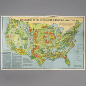
Map, United States, Pictorial, Agriculture and Meatpacking, Armour, Vintage Print, 1922
$850 -

Map, United States, Pictorial, America the Wonderland, Ernest Dudley Chase, Vintage Print, 1941
-

Map, United States, Pictorial, Bootlegger’s, Edward McCandlish, Vintage Print, c. 1941
$1,300 -

Map, United States, Pictorial, Bostonian’s Idea, Daniel K. Wallingford, Vintage Print
-

Map, United States, Pictorial, Ernest Dudley Chase, Vintage Print, 1935
-

Map, United States, Pictorial, Folk Music, Dorothea Dix Lawrence, Vintage Print, c. 1946
$1,200 -

Map, United States, Pictorial, Food, Louis Fancher, Vintage Print, 1932
$1,500