


Description
The map is not dated, but based on various criteria and other extant maps it was likely published between 1846 and 1848. As indicated above, the map is incorporated, as issued, in a book published in 1848 by Humphrey Phelps, though no publisher is given on the map and it could have been of slightly earlier date than the book. Indeed the map appears to be identical to one of the same title and border design shown on the Rumsey website, though the Rumsey example has full color shading of the states unlike the offered example. The Rumsey map has no publisher or date, but Rumsey states that it was published in 1846 based on various criteria, though this conclusion does not seem to be definitive. In another comparison, the map portion of the offered example appears similar (other than coloring and the presence of a distance table) to a dated 1848 version of the differently titled Ornamental Map of the United States and Mexico (shown on both the George Glazer website and Rumsey), which was printed as part of a vertically oriented broadside with additional illustrations and text above and below the map. Other examples of the offered map were also incorporated into other books by the Phelps firm and its associates, circa 1846-48, as discussed in notes in Rumsey.
Yale University’s Beinecke Library has a related version of the map though with some different place names, typeface, detail, etc., titled Phelps’ Ornamental Map of the United States and Mexico, which they have tentatively dated 1847. It is most noteworthy because like the map we offer, the Yale example uses a similar style of loosely hand-coloring various boundaries. Yale notes that their example “[a]ppears to have been colored after the Mexican War settlements in 1848, as the Gila River boundary is used.” Quite interestingly, the offered example does not use the Gila River boundary, but rather a mapping in which Mexico had extended further north prior to the end of the war in 1848.
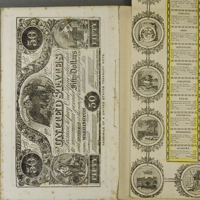
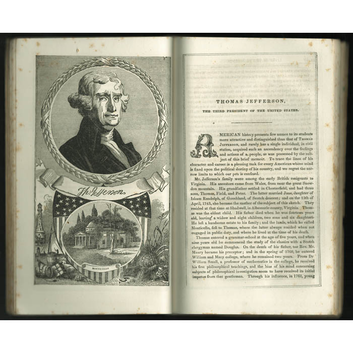
The Lives of The Presidents of the United States, the book into which this map has been attached, presents eleven biographies of presidents from George Washington through James Polk illustrated with engravings of their portraits and significant places. The text also includes the Declaration of Independence, the Constitution of the United States, Washington’s Farewell Address, a list of cabinet officers, and a Table of the Yearly Expenditures of the General Government. The final page is a full-page facsimile of a $50 treasury note. The author, Benson John Lossing (1813-1891) was an American historian known for his popular illustrated books on American history and features in Harper’s Magazine. He published over 40 books and is still esteemed today for his devotion to historical accuracy and fact checking to a degree that was unusual for his time. He sought out primary records, and where possible interviewed participants in events and people who knew his biographical subjects, making him a trusted source for later generations of historians.
Condition: Map generally very good, folds as issued into book, no margins beyond state seal border as issued, noting light toning, handling, wear. Book very good with the usual overall light toning and wear. Some slightly greater wear, handling, short tears, etc. to stiff paper covers but still overall very good.
References:
“Benton John Lossing.” Wikipedia. 7 June 2019. https://en.wikipedia.org/wiki/Benson_John_Lossing (1 July 2019).
“Map of the United States and Mexico.” David Rumsey Map Collection. 2019. https://www.davidrumsey.com/luna/servlet/detail/RUMSEY~8~1~222557~5505623:Map-Of-The-United-States-And-Mexico (1 July 2019).
“Map of the United States and Mexico Including Oregon Texas and the Californias.” David Rumsey Map Collection. 2019. https://www.davidrumsey.com/luna/servlet/detail/RUMSEY~8~1~222529~5505503:Map-Of-The-United-States,-Mexico,-O (1 July 2019).
“Ornamental Map of the United States & Mexico.” George Glazer Gallery. https://www.georgeglazer.com/archives/maps/archive-us/ensthayer.html (1 July 2019).
“Phelps’ Ornamental map of the United States and Mexico.” Yale University Library. 2019. https://brbl-dl.library.yale.edu/vufind/Record/4199131 (1 July 2019).