


Description
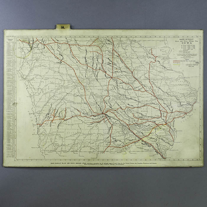
The original state maps (having one or two states, and with Texas divided into two maps) are the same as those in the Rand McNally Black and White Mileage Atlas of the United States, Canada and Mexico, published in 1922. Individual state maps on the same format were also separately issued as pocket maps in 1924. Overall, maps in either of these formats are apparently uncommon. The maps show the boundaries of counties and locations of towns along railroad routes, which are indicated by solid black lines with segments labeled with distances in miles. Mail routes to smaller towns are marked with dashed lines. Electric lines are also indicated. National parks and national monuments are labeled. Keys in the map borders indicate locations of cities and towns. Some of the maps include small inset maps of major metropolitan areas. The black-and-white maps in the offered set have been further customized with hand-drawn lines: current routes of the Rock Island Line are highlighted in red, removed Rock Island Lines with long dashed black lines, abandoned Rock Island Lines in red and yellow, and the lines of the St. Louis-San Francisco Railway another major rail company that operated in the some of the same territory, in green. Some creeks and rivers and other geographical features that intersect the Rock Island routes have also been added and labeled in black in this customized set.
The Rock Island and La Salle Railroad Company was incorporated in Illinois in 1847, and officially became the Chicago, Rock Island and Pacific Railroad in 1866, though it was popularly referred to through the years as simply the Rock Island Line. Its routes expanded through the Midwest and as far west as Utah and Arizona over the following decades, into the first half of the 20th century. It entered popular culture through the song Rock Island Line, written in the 1920s and recorded by many artists, including a well-known version by Johnny Cash. By the 1970s the Rock Island Line had dwindled to just two intercity trains in the Chicago area. The Chicago, Rock Island Pacific Railroad today is mainly a provider of railroad services.
Full publication information on each map: Rand McNally Black and White Mileage Atlas contains a complete set of mileage maps of each State in the United States, the Canadian Provinces and Mexico. Write Rand McNally & Co., 536 S. Clark St., Chicago, for particulars.
Condition: Maps generally very good with the usual overall light toning, handling wear. Case very good with light wear.
References:
“Chicago, Rock Island and Pacific Railroad.” Wikipedia. 15 September 2020. https://en.wikipedia.org/wiki/Chicago,_Rock_Island_and_Pacific_Railroad (12 October 2020).
Gorman, Chris. “James Edward Gorman. Find a Grave Memorial no. 151976324.” Find A Grave. 7 September 2015. https://www.findagrave.com/memorial/151976324/james-edward-gorman (13 October 2020).