

Description
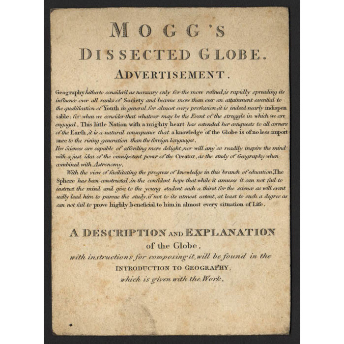
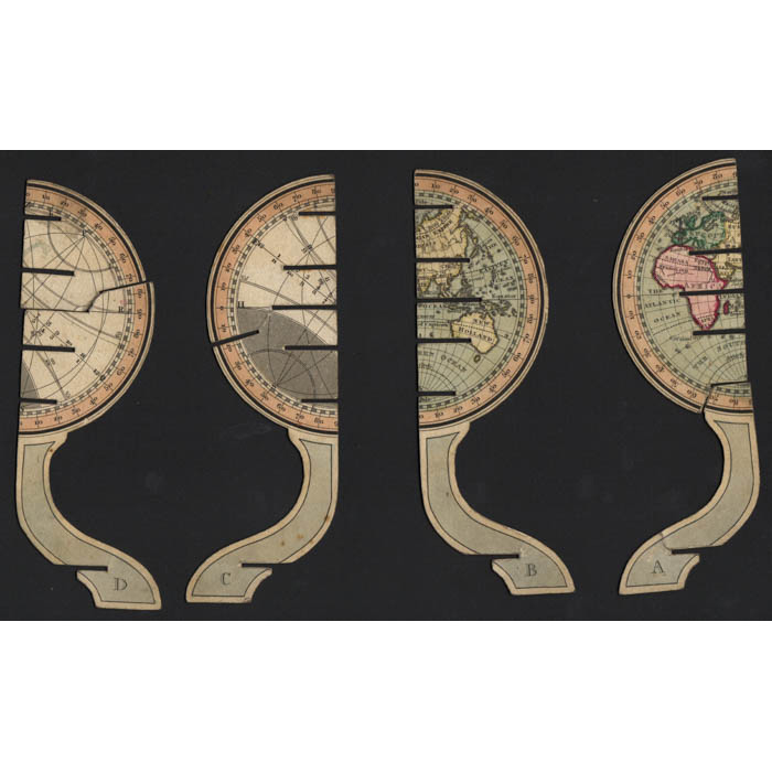
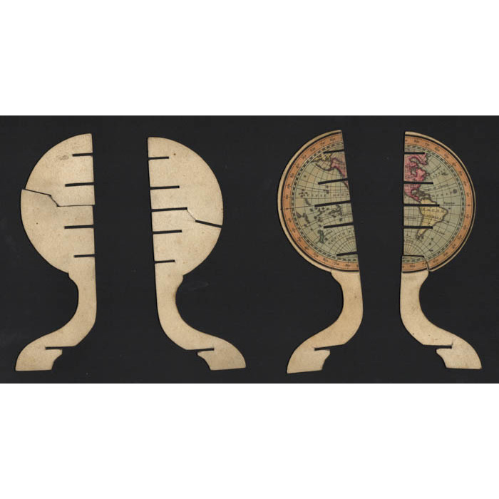
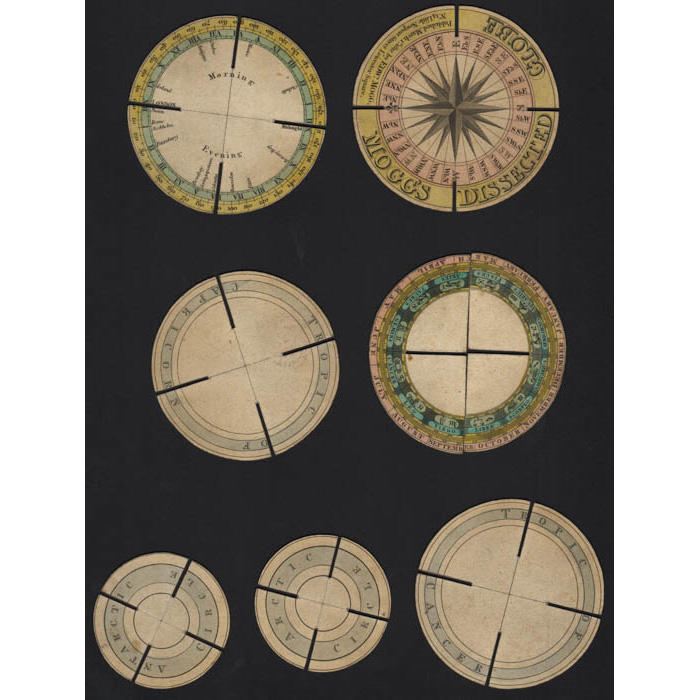
Four of the twelve sections of the globe are each formed as a leg supporting a hemisphere. When these sections are slotted together the legs are joined to form a stand and the hemispheres are united as flat rounded parts of the globe. Two of the hemispheres join to form a map of the eastern hemisphere (from Europe and Africa to Asia and Australia) within an outer meridian. The other two hemispheres have various celestial circles, also within the outer meridian. Six additional circular disc sections are as follows: a base with makers name and central printed compass, Tropics of Cancer and Capricorn, Arctic and Antarctic circles, and a horizon band. The final two sections are a circle in two halves representing the 12 signs of the zodiac. Originally Mogg’s sold the dissected globe in a colored paper slipcase envelope, with broadside advertisement and an instruction booklet. The dissected globe, when assembled, is somewhat similar conceptually to a Ptolemaic armillary sphere, but with a flat vertical geographical map in the center and with the horizontal rings represented by complete circles.
The globe was designed to provide its users – described by Mogg as “youth” – with an interesting and entertaining approach to globe lessons grounded in principles of object learning. In addition, the iterative construction and deconstruction of the globe by the student as part of its use provided supplemented development of construction skills. Mogg’s globe was produced early in the history of the development and adoption of globes as major elements in object learning, as part of a well-rounded education for children. At this time globes were not only objects of fascination and play for children, but also crucial educational devices that helped develop their understanding of geography, astronomy, as well as mathematics and other scientific disciplines. As discussed by British scholar Katie Taylor in her paper “Mogg’s Celestial Sphere (1813): the Construction of Polite Astronomy,” the educational philosophy was that students would be more interested and engaged, and could better conceptualize applicable educational disciplines through joyful interaction and play with a three-dimensional interactive educational objects. This belief helped lay the groundwork for the production and use of globes throughout the 19th Century as educational demonstration devices for both schoolrooms and home settings.
Edward Mogg was a 19th-century English publisher and cartographer best known for his detailed maps and practical travel guides during a time of rapid urban and industrial growth in Britain. Operating primarily out of London, he gained prominence for works such as Mogg’s Strangers Guide to London and Stranger’s Guide to the Roads, Rivers and Railways of England and Wales, which provided essential information for travelers navigating the city and the expanding national transport network. His publications combined maps, landmark descriptions, and transit details, making them invaluable to both locals and visitors. Mogg’s work captured the transformation of Britain’s landscape during the Georgian and early Victorian periods, and his maps remain important historical documents preserved in archives today. Nonetheless, Mogg is perhaps best known for his publication in 1812 of a flat, assemblable “dissected globe” designed to provide object learning for students.
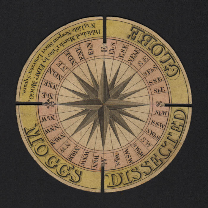
Title on covers: “Mogg’s Dissected Globe / For the Instruction of Youth in Geography/ Published by Edward Mogg / No. 14 Little Newport-Street, Leicester-Square, London.
Legend on base: Mogg’s Dissected Globe. Published March 1st 1812 by Edw’d Mogg / No. 14 Little Newport Street. Leicester Square.
References:
Taylor, Katie. “Learning with dissectable paper globe kits,” Whipple Collections, Whipple Museum of the History of Science, University of Cambridge, 2009.
Taylor, Katie. “Mogg’s celestial sphere (1813): the construction of polite astronomy.” Studies in History and Philosophy of Science. Trinity College, Cambridge: 2009.


