Click main image below to view enlargements and captions.

View, Washington State, Seattle, Tacoma, Puget Sound, Olympic Peaks, Vintage Map, 1962 (Sold)

This item is sold. It has been placed here in our online archives as a service for researchers and collectors.

To find similar items in stock, browse or search our currently available items from our menu.

• See our guidelines for the use of images.
Contact the gallery with purchasing and ordering inquiries, or to offer items for sale.

Frank Dippolito (artist)
The Olympic Peaks
George W. Martin, Bremerton, Washington: April 20, 1962
Photo-process print, mounted on board, as issued
14.5 x 33 inches, map
15.5 x 34.5 inches, framed

Bird’s-eye view printed in the style of an oil painting, in an ebonized frame, of the Olympic peaks with the Puget Sound region of Washington State in the foreground, as seen from Seattle and Tacoma. Seattle is shown in the lower right, Tacoma lower left, beyond them Puget Sound, Vashon Island, Bremerton, and Hood Canal, with the Olympic Mountains range in the distance. The Seattle Space Needle, which had been completed a few months before for the Seattle World’s Fair, is shown. The publication date of this map coincided with the opening of the fair. The title and elevation detail are attached to the back of the frame.

Product description continues below.

Description

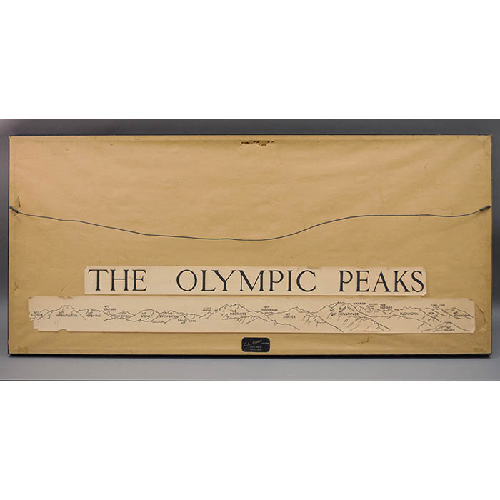
Frank Dippolito was a member of the art department at Olympic College, Bremerton, Washington, when he was commissioned by George W. Martin, college registrar and leader of the mountaineering and rescue and survival classes, to make this painting of the region to be published as a print. Martin had already published a pictorial map of the region by Richard Arnold Pargeter, and coordinated the printing and marketing of these locally. After Martin’s death, his daughters gave the reprinting rights for The Olympic Peaks to Pargeter, who redid the lettering of the place names and added a pen-and-ink drawing in the margin above Dippolito’s rendering identifying the mountains and their elevations, and continued to issue reprints.

References:

“Olympic Peaks Skyline Panorama.” Richard A. Pargeter, Pictorial Maps. http://www.pargetermaps.com/maps/op/op.html (16 January 2008).

Pargeter, Richard Arnold. E-mail correspondence to George Glazer Gallery. 10 December 2007.

Additional information

Century

20th Century