
Description
Waugh’s map of Old Cape Cod was rendered and issued by him in two different versions, one published in 1926 and the other published in 1930. These maps were also issued in various sizes. The Cape Cod maps were often hand-colored, possibly by Waugh or otherwise by assistants in his studio, thus giving rise to variations among them.
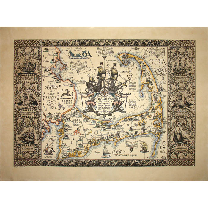
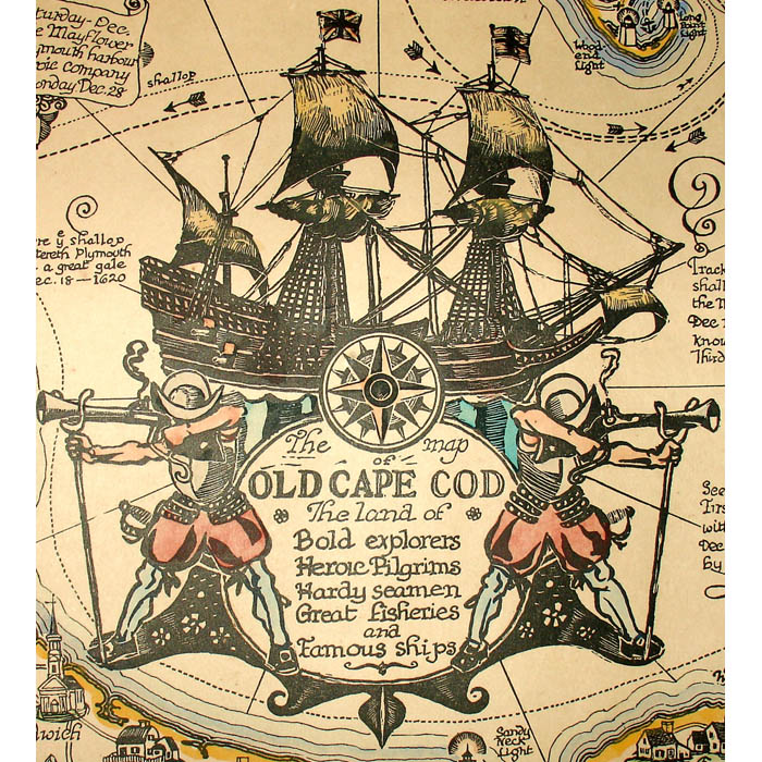
Coulton Waugh was an artist specializing in both illustration and fine art including pictorial maps and comics. He is often credited with being at the forefront of reviving the art of decorative mapmaking in the 20th Century with his creation of a large silk pictorial map of Cape Cod, exhibited in 1918 at the International Silk Show. Waugh took over drawing the comic strip Dickie Dare from its creator Milton Caniff in 1933 , continuing until 1957. He also wrote a seminal history of cartooning called The Comics (1947), one of the first serious examinations of the medium. He taught art and authored instructional books on cartooning and palette-knife painting.
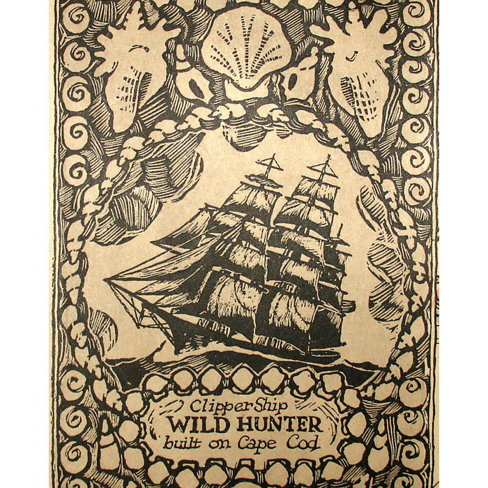
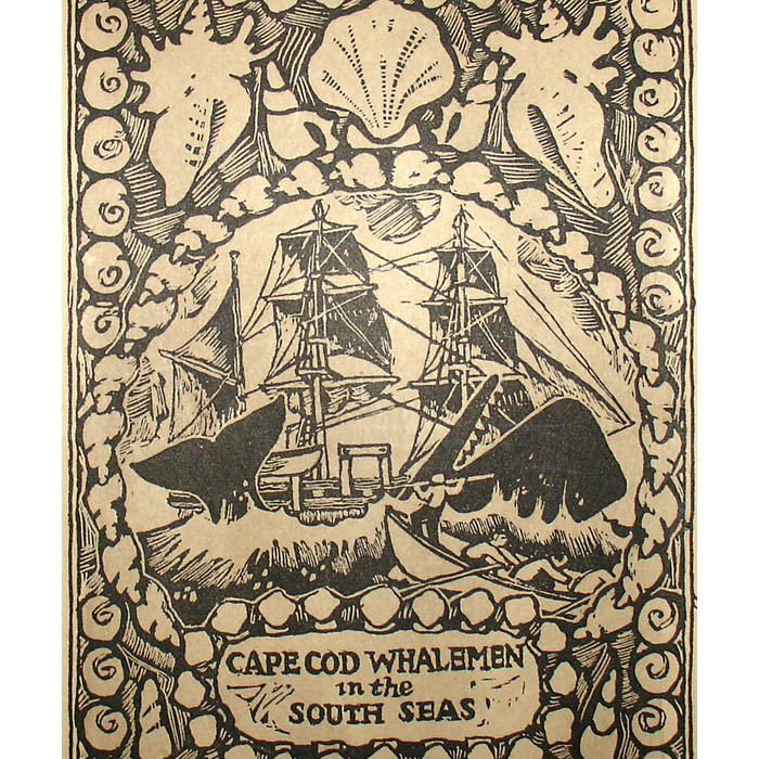
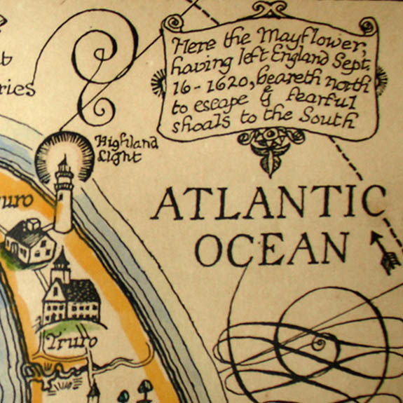
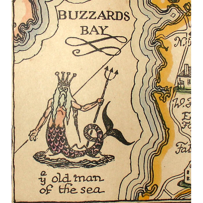
In 1922, Waugh created a whimsical map of Greenwich Village for The World Magazine, portraying people in a cartoon style that later became evident in his work in comics. Nonetheless, in his maps, Waugh generally took a serious and scholarly approach to both local geography and history, with illustrations in a traditional style often resembling woodblock prints. The son of the renowned maritime painter Frederick Waugh, he also infused his own maps with maritime themes, including historic ships, elaborate compass roses, and fantastical sea creatures. In this manner, he created several maps of Cape Cod in two different versions, and in various sizes (1926, 1930). He also executed a related map of Cape Ann, Massachusetts (1927) and in 1928 he made one of Long Island that showed the Connecticut coast on the Long Island Sound as well. An additional two of his particularly rare maps of this prolific period were of Saint Paul’s School, Concord, New Hampshire (1929) and Racing Routes of the Yankee Clippers (1935). About the time these maps were being published, Waugh sold them, along with other prints, at his Ship Model Shop of Cape Cod in Provincetown and through catalogs. A later Waugh map that included a maritime theme was Ye Mighty Hudson River (1958). Waugh’s maps were issued in black and white, and some with hand color, the later either by Waugh himself, or assistants in his studio.
Condition: Map generally very good, recently professionally cleaned and deacidified, with only light remaining toning and wear.
References:
References:
“Coulton Waugh.” Lambiek.net. 18 January 2003. https://www.lambiek.net/artists/w/waugh_coulton.htm (11 March 2020).
Creason, Glen. “A Smile of Understanding.” Mercator’s World Magazine. September-October 1999. Online at: http://www.garbell.com/creas/creason-smile-und-Sp99.html (30 January 2003).
“Destination Plymouth: Picture Maps.” Plimoth Plantation. http://www.plimoth.org/plymtour2/asb-guid.htm (30 January 2003).
Guadazno, Laurel. “Coulton Waugh.” Provincetown Banner. 31 August 2000. http://www.provincetownbanner.com/history/8/31/2000/1 (30 January 2003).
Hornsby, Stephen J. Picturing America: The Golden Age of Pictorial Maps. Chicago: University of Chicago Press, 2017. pp. 46-47, 160-161, plate 81.


