specialty globe

  • Click main image below to view enlargements and captions.

    Globe, American, Specialty, World’s Fair, Chicago 1933, Cram, Terrestrial World, 1933

    This globe is currently on reserve among numerous extremely fine and rare American globes to be sold as a single collection. Meanwhile it has been placed here in our American Globe Guide as a service for researchers and collectors.

    Browse our currently available Globes & Planetaria or search our site to see globes offered for individual purchase.

    George F. Cram Co.
    7-Inch Terrestrial Globe –“A Century of Progress”
    Indianapolis, Indiana: c. 1933-1934
    Black-painted metal stand
    10.5 inches high overall

    A rare and historically significant 7-inch terrestrial table globe produced by the George F. Cram Company as a specialty novelty souvenir commemorating the 1933-1934 Chicago World’s Fair, officially titled “A Century of Progress.” The globe is surmounted by an hour circle at the North Pole axis, and is mounted on a black-painted metal stand at 23 degrees within a simple flat semi meridian, raised on a circular bulbous shaped support, on a circular base decorated with an applied inset paper disc featuring vignettes of major exposition sites and attractions of the Fair: the Hall of Science, Travel and Transport Building, and the Federal Building; the Temple of Jehol (Chinese Pavilion); Admiral Byrd’s Polar Ship; as well as the 1933 A Century of Progress official logo.

    Product description continues below.

    Description

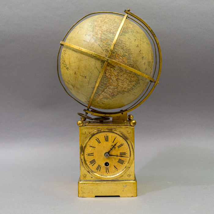
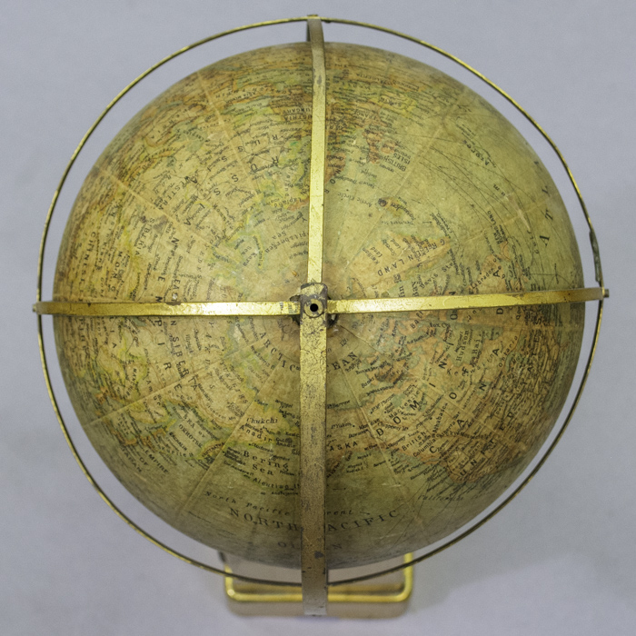
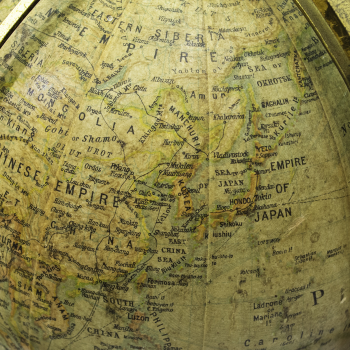
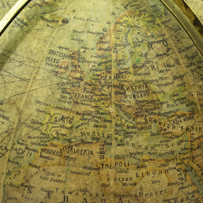
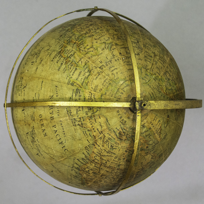
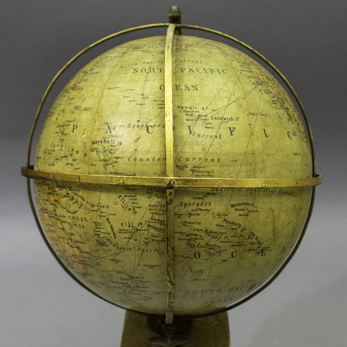
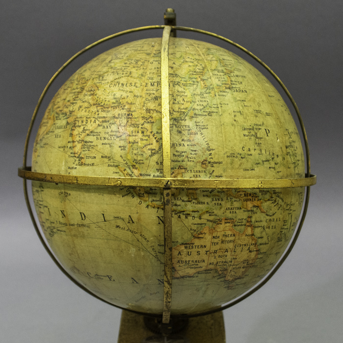
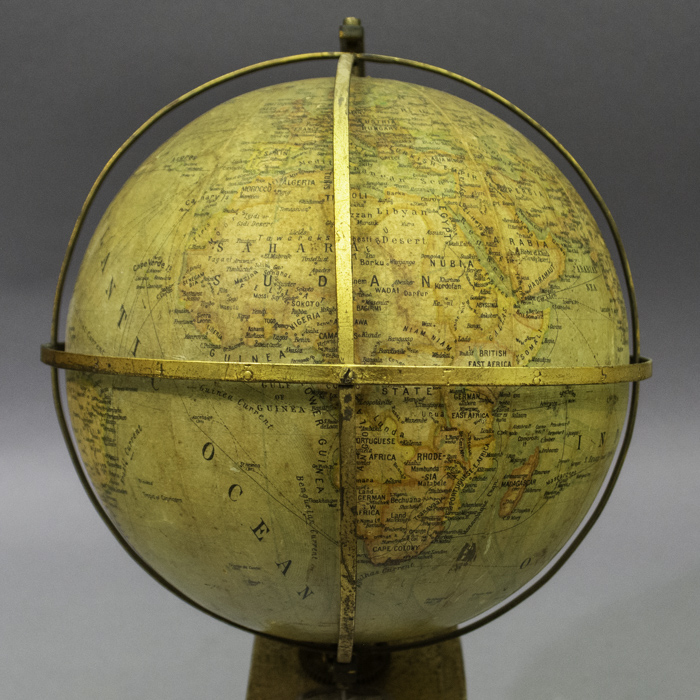
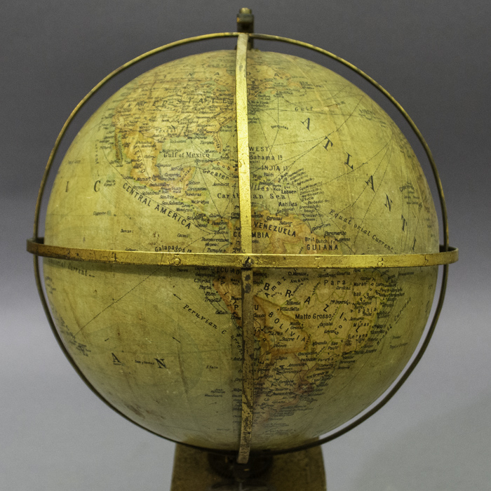
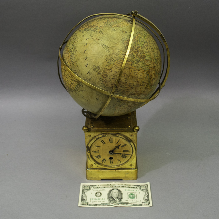
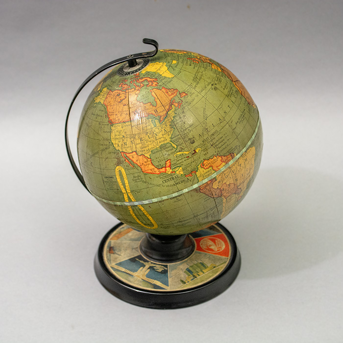
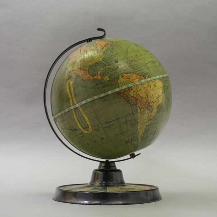
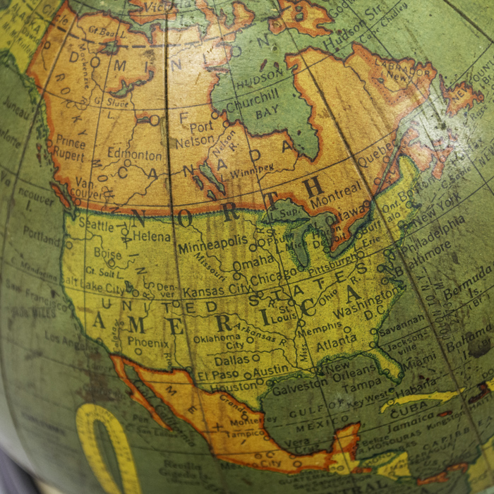
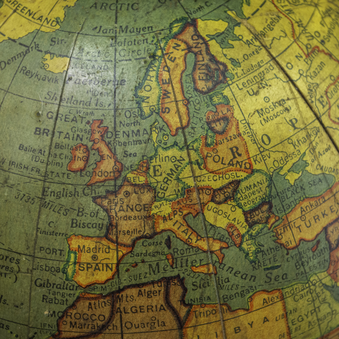
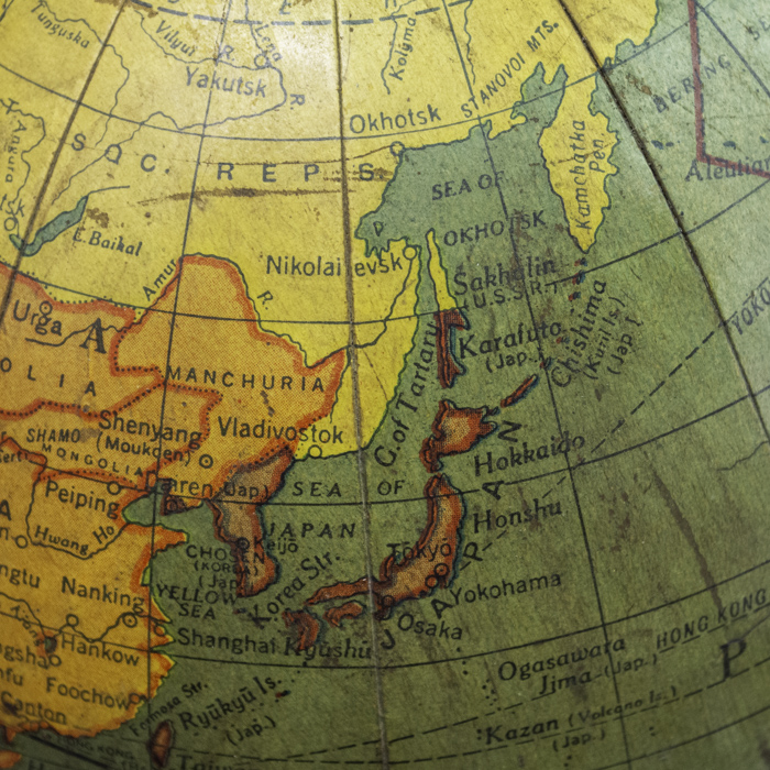
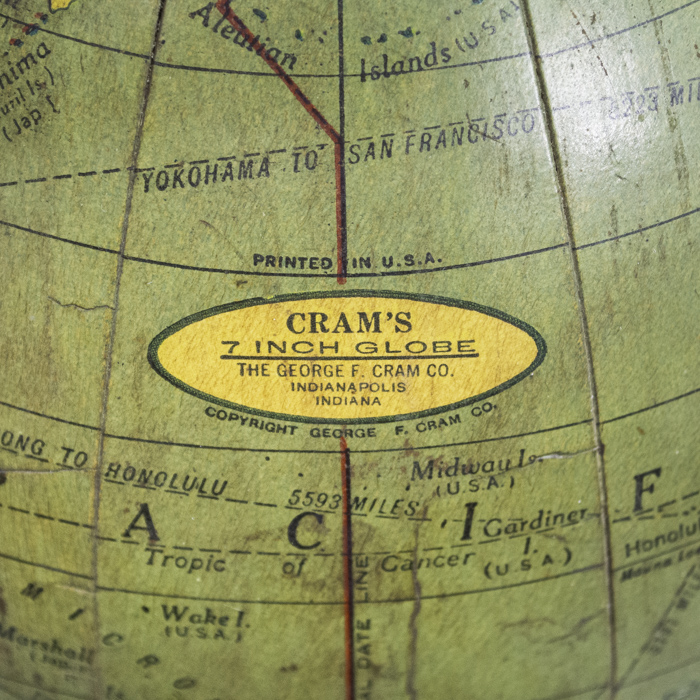
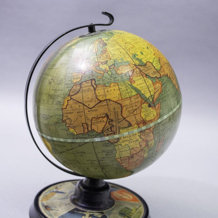
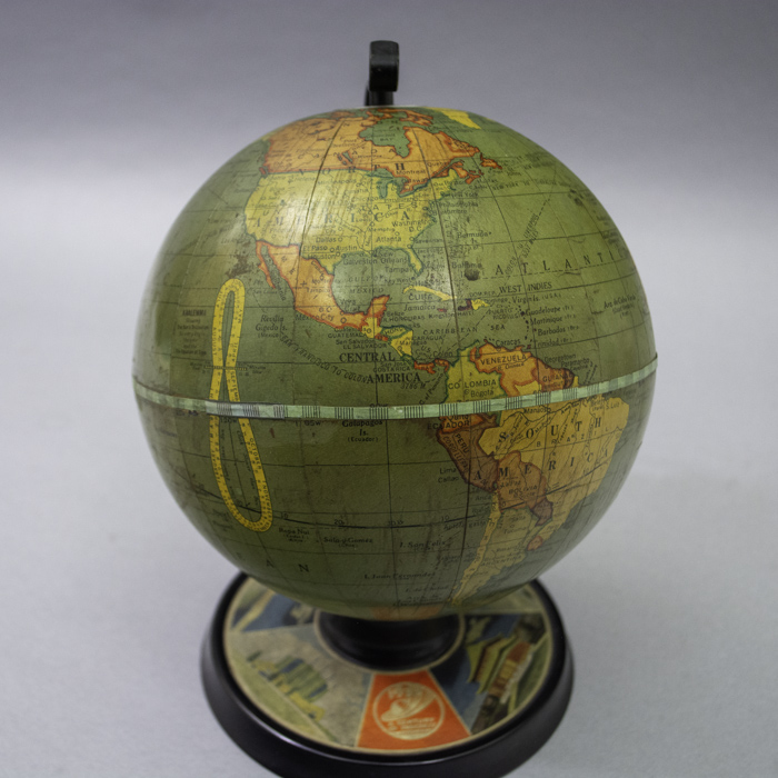
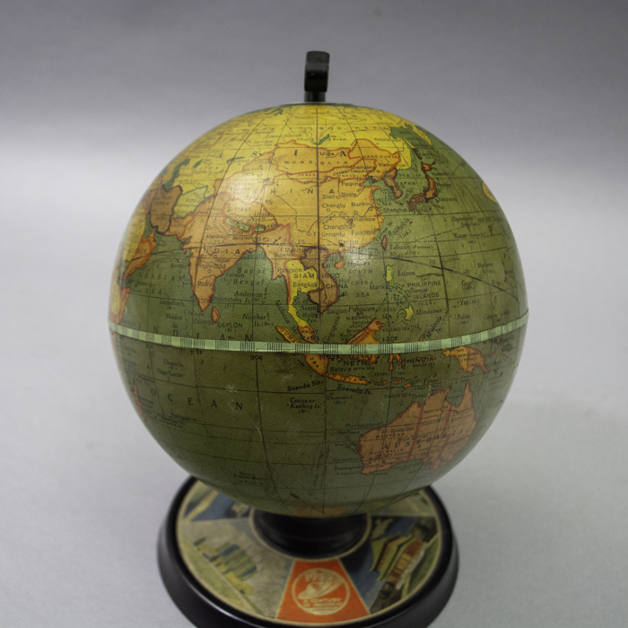
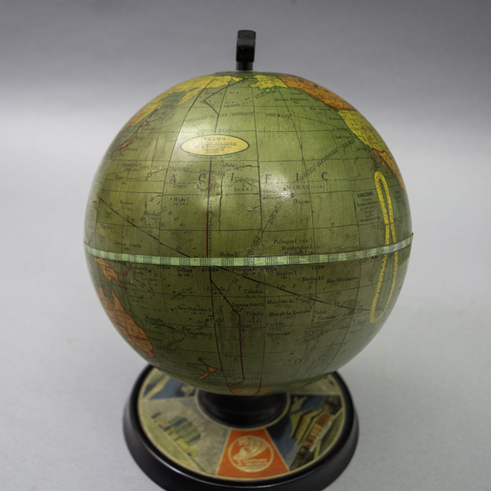
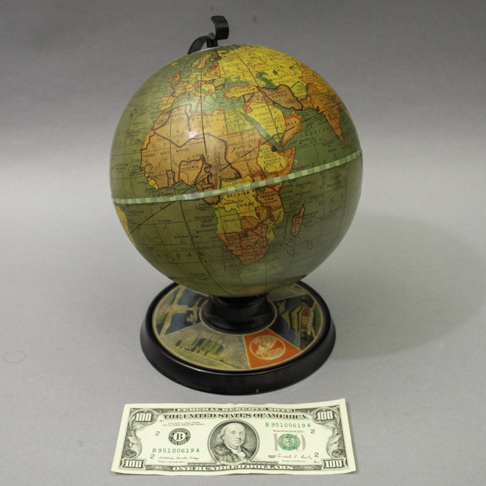
    The cartography provides a snapshot of the world during a period of significant territorial shifts. For example, “Chosen (Korea) (Jap)” is so named reflecting the formal Japanese annexation from 1910 to 1945. Central Europe reflects the post-WWI landscape, showing Czechoslovakia (post 1918) and a unified Poland (realized circa 1920s to early 1930s). The city of Leningrad is clearly marked within the borders of the U.S.S.R. dating the globe after 1924. Palestine is shown, indicated a date before 1948. The globe includes a prominent yellow analemma in the Pacific Ocean, used to calculate the sun’s declination and the equation of time.

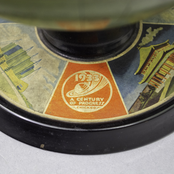
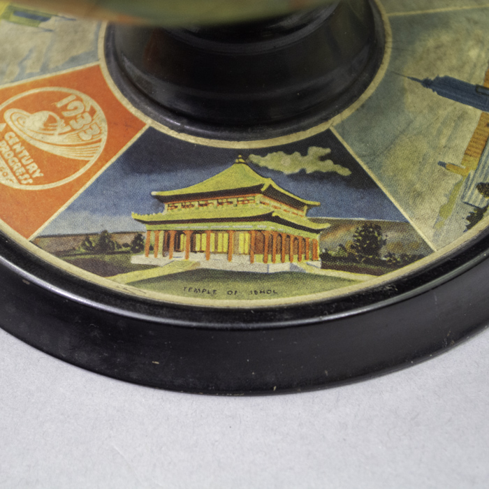
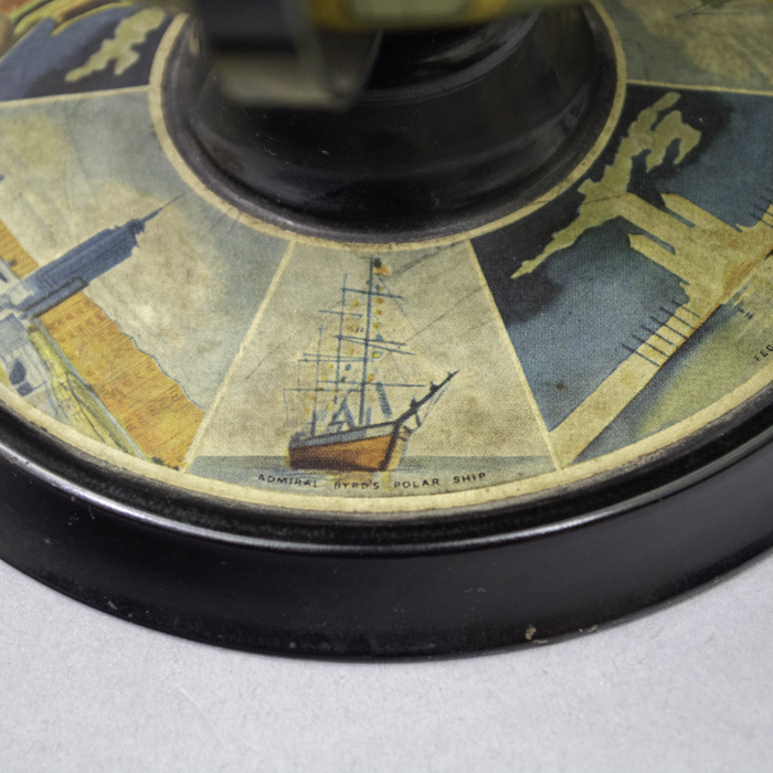
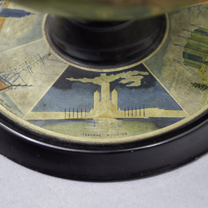
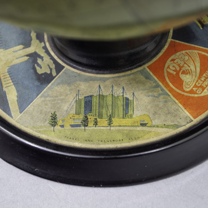
    During the early twentieth century, the George F. Cram Company and other American globe makers  utilized major international trends and events – in this case  the Chicago World’s Fair — to reach new audiences, specifically targeting students and young people. This globe served as an educational geographical souvenir. It enabled visitors to the Fair to bring home a global vision that made the complex geopolitical landscape of the period between the world wars accessible to schoolchildren. While the 1893 World’s Fair announced America’s entry onto the world stage, the 1933 Century of Progress International Exposition promoted the nation as an established powerhouse capable of leading the global economy out of the Great Depression. The 1933 Fair shifted focus from national government displays to massive corporate dominance. Major corporations like General Motors, Sears, and Havoline built their own impressive pavilions to showcase their global reach. The fair’s motto, “Science Finds, Industry Applies, Man Conforms,” explicitly framed America as a prime innovator for the world’s future industries.  

    The George F. Cram Company, originally a producer of maps and atlases in the 19th century, emerged in the 20th century as one of the leading American globe makers. The company was founded by George Franklin Cram (May 20, 1842 – March 24, 1928). The George F. Cram Company continued even after George F. Cram sold his interest upon retirement in 1920 to the National Map Company. Read more about the George F. Cram Company of globe makers in our Guide to Globe Makers.

    This exceptional globe is a notable inclusion in our reserved George Glazer Gallery Special  Collection of American globes, representing World’s Fair globes as a specific subgenre of specialty and novelty globes. It represents and promotes the core themes of Chicago’s Century of Progress, symbolizing American internationalism and the country’s emergence as a global economic power represented by its corporations in a variety of fields including manufacturing and retail.

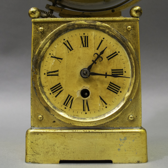
    This globe is quite rare, particularly when found in such fine condition. It possesses significant crossover appeal, attracting collectors of both antique cartography and World’s Fair memorabilia. While standard 12-inch Cram globes from this era are more common, the 7-inch novelty Fair edition, with its unique pictorial base with images of sites and attractions of the Fair, is superior for its thematic depth.

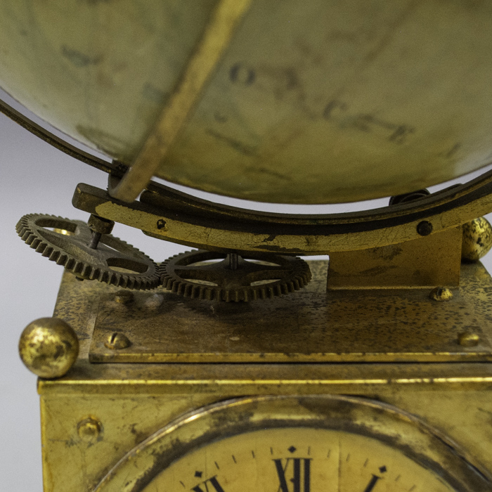
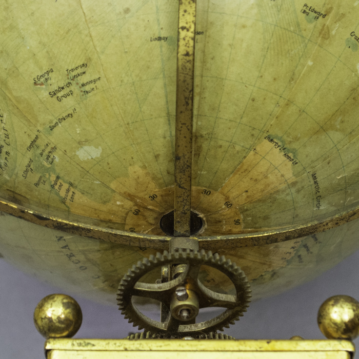
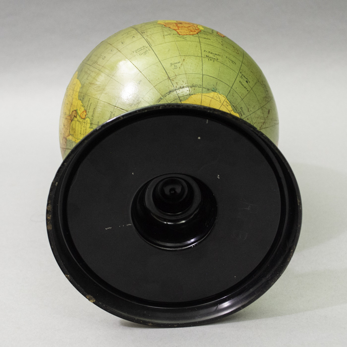
    Condition:  Globe and applied paper disc to stand generally very good with the usual overall light toning, wear, handling. Few repairs and replacements to small sections of equator tape. Base well-preserved with only light oxidation, handling, abrasions, tiny indentations.

    References

    “A Century of Progress Exposition Records.” Chicago Public Library, Special Collections.

    Cram’s Universal Terrestrial Globe. Indianapolis: The George F. Cram Co., c. 1934.

    Danzer, Gerald. “George F. Cram and the American Perception of Space.” Chicago History 13, no. 1 (1984): 32-46.

    George Glazer Gallery Archives. “Cram Terrestrial World 12-Inch Table Globe.” Accessed March 4, 2026. https://www.georgeglazer.com/wpmain/product/globe-american-cram-terrestrial-world-12-inch-table-globe-red-ocean-indiana-early-1950s/.

    Additional information

    Maker Location

    Globe Type

    Terrestrial

    Material

    Tin

    Century

    20th Century

  • Click main image below to view enlargements and captions.

    Globe, Specialty, Clock, 7-Inch Terrestrial World, Continental, c. 1900 (sold)

    This globe is currently on reserve among numerous extremely fine and rare American globes to be sold as a single collection. Meanwhile it has been placed here in our American Globe Guide as a service for researchers and collectors.

    Browse our currently available Globes & Planetaria or search our site to see globes offered for individual purchase.

    7-inch Terrestrial Globe Clock
    Continental for the English market, circa 1890-1907
    Gilt metal rectangular stand
    15 inches high, 4.75 inches wide, 3.5 inches deep

    An antique terrestrial globe clock featuring an unsigned 7-inch terrestrial globe canted at 23 degrees within a brass half meridian and framed by a brass equatorial horizon band engraved with the hours of the day in Roman numerals, alongside corresponding solstice and equinox bands. The globe gear assembly is raised on a rectangular gilt metal clock case featuring a paper dial with Arabic numerals. The clock is powered by an unsigned, one-day spring-wound movement. Although the globe is unsigned, it features place names in English, as manufactured for export to England or the United States. Railways, steamship routes, and ocean currents are delineated. In the late 19th and early 20th centuries various Continental, English, and American clock makers produced similar models of a terrestrial globe turning by clockworks on a base with internal works powering a standard clock face with hour and minute hand set within the base. They were designed for parlor or business use to serve as a functional clock to keep local and international time, while also functioning as a decorative arts object. To operate the instrument, the user adjusts the clock hands to local time and rotates the globe until the user’s specific geographic location aligns with the correct time on the equatorial hour circle. Once set, the winding of the clockworks not only powers the traditional clock face but simultaneously turns the globe counterclockwise, completing a full rotation once every twenty four hours. This mechanism allows the user to determine the current local time for any place in the world simply by referencing the equatorial hour circle against the globe’s longitude lines.

    Product description continues below.

    Description

    Certain cartographical features date the globe to between 1890 and about 1907. For example, modern-day Oklahoma is divided between Oklahoma, referring to Oklahoma Territory in the west, and Indian Ter., an abbreviation for the Indian Territory in the east. These boundaries reflect the 1890 Oklahoma Organic Act, which created the Oklahoma Territory and Indian Territory out of a combination of the region’s “unorganized” Indian Territory, Greer County, and the Oklahoma panhandle. Prior to the incorporation of the panhandle into Oklahoma Territory, it had been designated as a “neutral strip” starting in 1820 with the drawing of the 36°30′ line in the Missouri Compromise. In 1907, Oklahoma achieved statehood, and was indicated on globes as such at that time or shortly thereafter rather than a territory in any part. A second telling feature is the division of the Dakotas, named Nth. Dakota and Sth. Dakota, in accordance with the  admission of North Dakota and South Dakota as the 39th and 40th states in November 1889. In addition, St. Petersburg is indicated in the Russian Empire, consistent with a date before about 1914; regardless Oklahoma prior to statehood dates it earlier as set forth above.

    Clocks are exceptionally well suited to be combined with globes because world time is inherently based on the full rotation of the Earth every 24 hours. The time of day or night varies with longitudinal location, divided into twenty four standard time zones across the world. Traditionally, globes are divided into twenty four longitudinal lines set fifteen degrees apart. It takes the Earth one hour to turn fifteen degrees and thus a full rotation of 360 occurs once a day.

    Reference:

    “Globe Clocks.” NAWCC Bulletin, June 1999, p. 423. 

    Additional information

    Century

    20th Century