Description
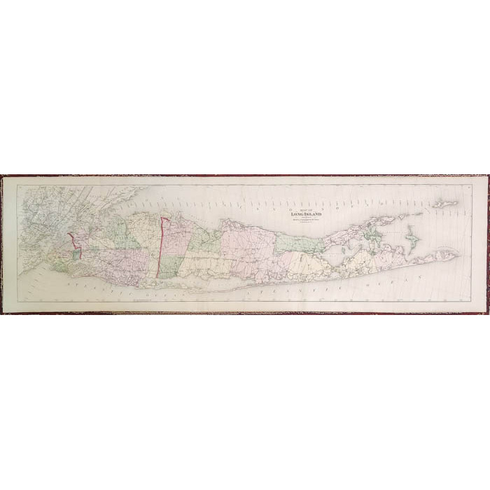
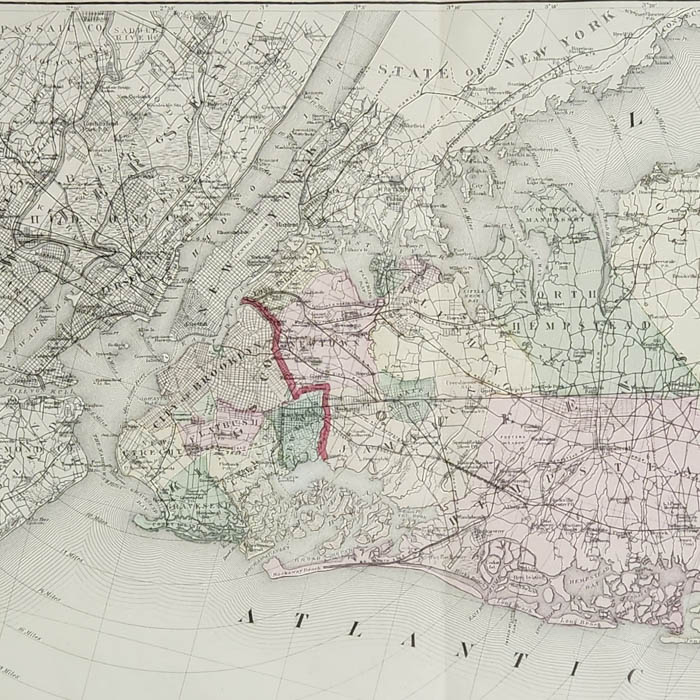
Frederick W. Beers joined his cousin, James Botsford Beers (b. 1811), in founding the J.B. Beers & Company publishing house in New York in 1870, which became a prolific publisher of county and city atlases, maps and county histories. The Beers family sometimes worked separately, sometimes in collaboration with each other or with other publishers, and were involved in the production of a large number of the atlases of East Coast counties between 1865 and 1900. In addition, F.W. Beers published atlases under his own imprint for more than 80 counties in 10 states, including Vermont, Maine, Massachusetts, Pennsylvania, Ohio, New York and Michigan, as well as several city atlases. He established temporary partnerships with local surveyors to produce many of these atlases. Beers lived in Brooklyn, where he was also employed as head of the map division in the Brooklyn Office of Public Records for 35 years. His long career continued until his retirement at the age of 90.
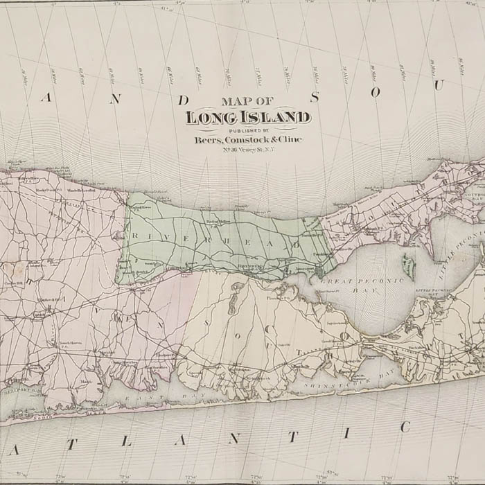
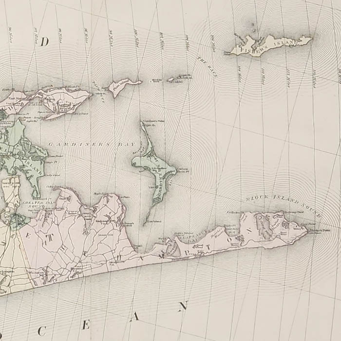
Long Island was among the first areas in the New World reached by European settlers. The town of Southampton on the eastern tip was settled in 1640. The island and its coast were mapped in the 18th century by the British up to the time of the Revolutionary War. The best-known sea charts were made for the British Admiralty by F.W. Des Barres. In the 19th century, a concerted effort began in the America to map the interior of the United States. This mid 19th century map was a joint effort by W.W. Mather, a geologist, and the surveyor J. Calvin Smith, also well known for his huge wall map of the State of New York. By the end of the 19th century, the Long Island Railroad was actively promoting development on the island, and issued many maps to encourage New York City residents to build houses and farms east of the city. The offered map shows what are now popular vacation locations on Long Island including West Hampton, East Hampton, Southampton, Bridgehampton, Sag Harbor, Amagansett, Montauk, Glen Cove, Jones Beach, and Fire Island.
Condition: Recently professionally cleaned and deacidified, and backed on mulberry paper, stabilizing vertical folds as issued and a few short marginal tears, now with light remaining toning, handling, and wear.
References:
Allen, David Yehling. Long Island Maps and Their Makers. Mattituck, NY: Amereon House, 1997. pp. 94-97.
Ristow, Walter W. American Maps and Mapmakers: Commercial Cartography in the Nineteenth Century. Detroit: Wayne State University Press, 1985. pp. 406-409.