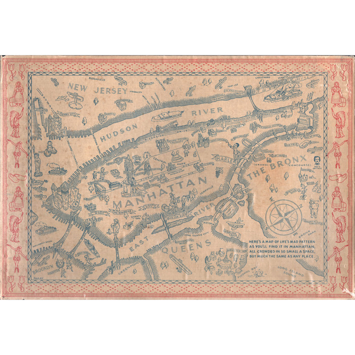
Click main image below to view enlargements and captions.

Map, New York City, Pictorial, Pakay, Vintage Print, 1939

Pakay
[Life’s Mad Pattern in Manhattan]
N.p,: c 1939
Color-process print on linen weave paper
10.75 inches x 15.5 inches, overall

Here’s a map of life’s mad pattern, as you’ll find it in Manhattan, all crowded in so small a space, but much the same as any place.

A detailed and amusing pictorial map of New York City filled with cartoon style illustrations. Neighborhoods are indicated with pictorial representations including Harlem, “The Bouwerie” and Tudor City. The map has illustrations of major areas and attractions such as the Empire State Building, the Metropolitan Museum, Madison Square Garden, Washington Square Park and Central Park. The cartography is simple, with names applied to major roads such as Riverside Drive, Fifth Avenue, and Park Avenue. The West Side Highway is labeled as the “Elevated Express Highway.” Notably, the map includes Upper Manhattan—often omitted in similar works—featuring landmarks like Grant’s Tomb, Columbia University, Barnard College, and Inwood Hill Park. While the focus remains on Manhattan, the map includes bridges to, and notable sites of Brooklyn, Queens, the Bronx, and New Jersey. Roosevelt Island is marked as “Welfare Island.”

Product description continues below.

Description

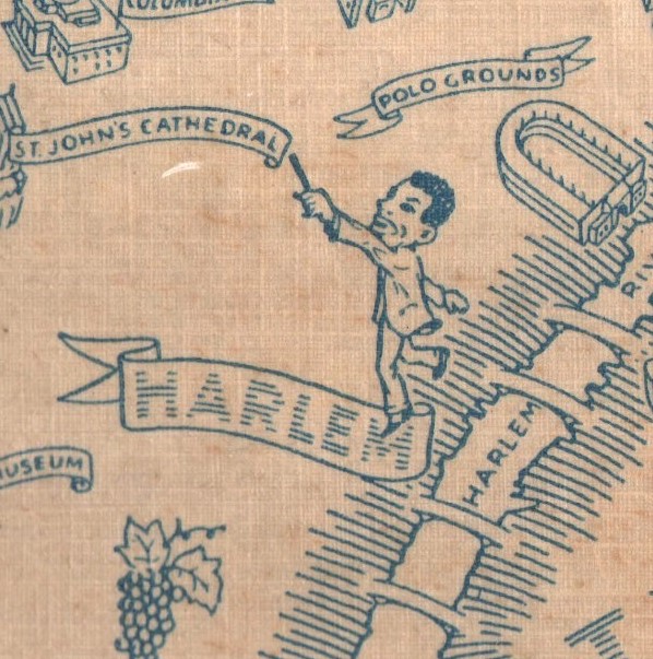
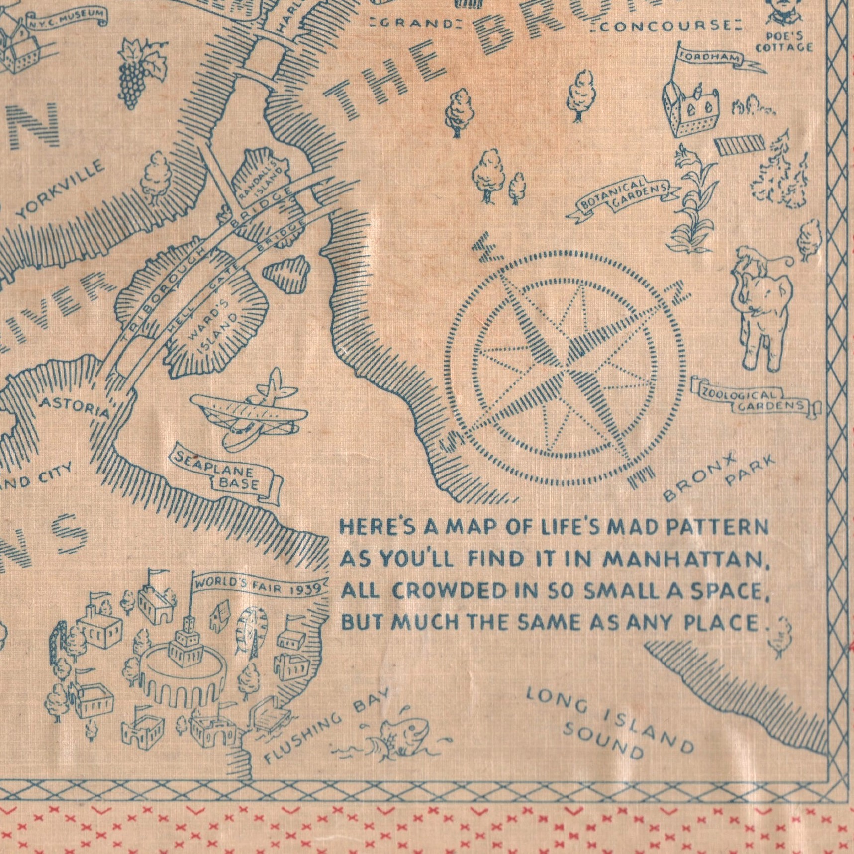
Playful illustrations add subtle humor: an artist with a pronounced mustache paints on an easel in Greenwich Village, a monkey rides an elephant at the Bronx Zoo, and a floating money bag drifts through the Financial District. The 1939 World’s Fair site is labeled and dated, with numerous illustrations. Based on other extant pictorial maps of Manhattan, this likely is an indication that the map was specifically made at that time for tourists for this event. The main map illustrations are rendered in blue. The map has a decorative border in red featuring illustrations of New York’s origins: a Native American chief, a Dutch female settler, wooden shoes, and a female night club or theater dancer. The map is signed in the matrix “Pakay.” No information about the artist has been located. This map is apparently rare. Only one other example is known.

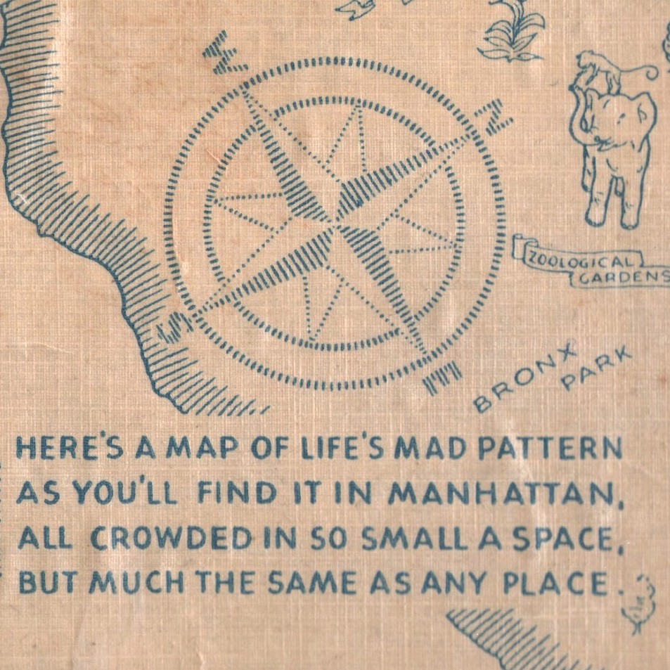
An amusing poem — from which we have drawn a title for the map – is in the lower right corner.

Here’s a map of life’s mad pattern
as you’ll find it in Manhattan
all crowded in so small a space
but much the same as any place.

Condition: Generally very good with the usual overall light toning, handling, and wear. Few pale discolorations. Printed on linen weave paper with varnish finish, resulting in slight scattered bubbling of paper.

Additional information

Century

20th Century