

Description
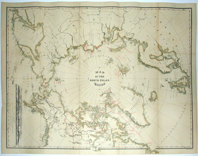
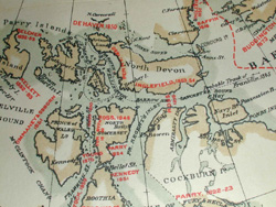
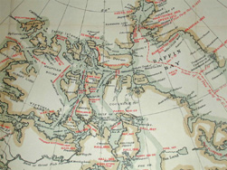
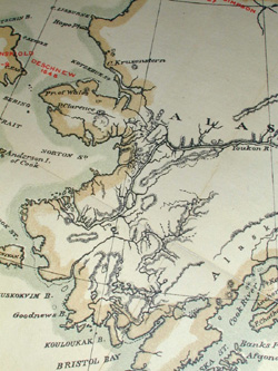
The map shows raised topography, major rivers, and a side view of Wrangell Land, as seen from Bark Nile of New London. The view is taken from the U. S. Hydrographic Office Chart No. 68, documented in the U.S.N. Pacific Surveying expedition in 1855, under Commander John Rodgers. A fine amount of attention is given in the portrayal of the northernmost coastlines of the continents of the northern hemisphere, with extensive detail given to Alaska and Northern Canada, among others.
Admiral John Rodgers (1812-1882) led the United States surveying and exploring expedition in the North Pacific and China Seas in 1852-55. In April, 1855, he made a voyage into the Arctic Ocean, obtaining valuable commercial and scientific information. He was commissioned commander, 14 September, 1855, and continued on special duty in connection with the report of the exploring expedition. During the Civil War, he served the Union side with distinction, rising to the rank of admiral by 1869. Elected a member of the National Academy of Sciences in 1863, he also made important contributions to science and technological development in such areas as lighthouse building, as chairman of the Light-House Board, and astronomy as director of the Naval Observatory.
Full publication information: The Graphic Co., 39 & 41 Park Place, New York.
Condition: Generally very good with the usual light overall toning and wear. Formerly dissected and folded, now professionally joined as one sheet on linen.
Reference:
“John Rodgers.” Appleton ‘s Encyclopedia on Virtualogy.com. 2001. http://www.famousamericans.net/johnrodgers1 (2 February 2004).