


Description
The pineapple industry in Hawaii began in 1901 when horticulturist James Dole began growing pineapples on Oahu and established the Hawaiian Pineapple Company. By 1915, the company was Hawaii’s second largest industry. In 1933, its marketers recognized Dole’s name as iconic, and began using it on canned pineapples and juice. The company eventually expanded into other fruits and produce, and the entire brand was named Dole, which it remains today.
Parker Edwards was an illustrator based in his native California. In 1940 he was living in San Francisco. He worked primarily in watercolor and made at least two pictorial maps, an iconic pictorial map of the Hawaiian Islands advertising Dole Pineapples and a map of the wineries in Sonoma County, California. Edwards was the third husband of the popular humor writer Peg Bracken.
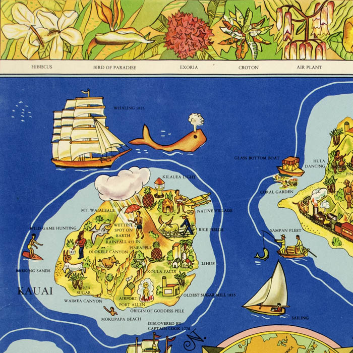
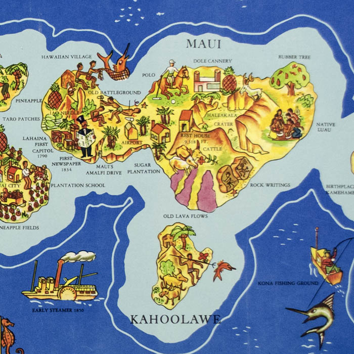
Full Title: The Dole Map of the Hawaiian Islands, U.S.A. Being a descriptive portrayal of the history, transportation, industries and geography of the Territory of Hawaii, U.S.A.
References:
“Dole Map of the Hawaiian Islands U.S.A.” David Rumsey Map Collection. 2019. https://www.davidrumsey.com/luna/servlet/detail/RUMSEY~8~1~260653~5522978:Dole-Map-of-the-Hawaiian-Islands-U-
“Dole Timeline.” Dole Food Company. 2017. http://www.dole.com/AboutDole (20 August 2019).
“Parker Edwards.” Askart.com. 2019. http://www.askart.com/artist_bio/Parker_Edwards/11216057/Parker_Edwards.aspx (20 August 2019).