
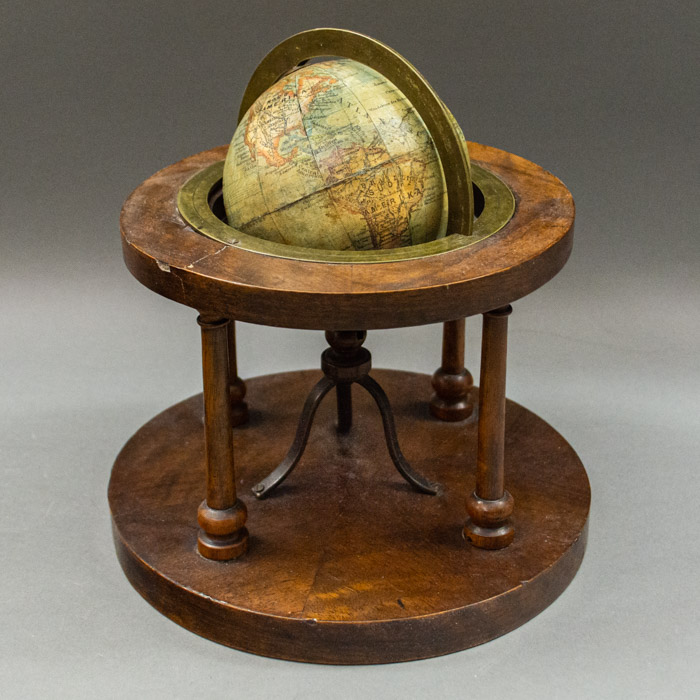
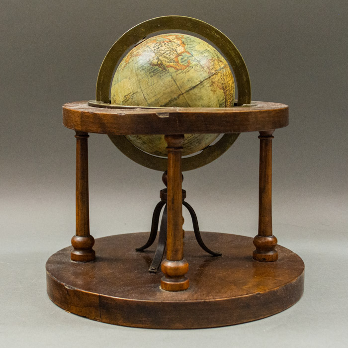
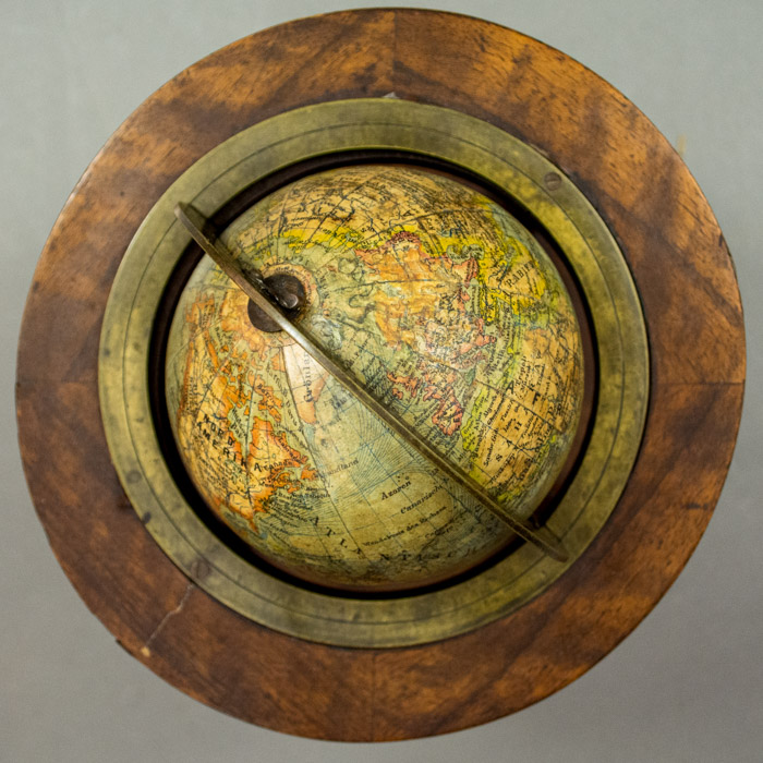
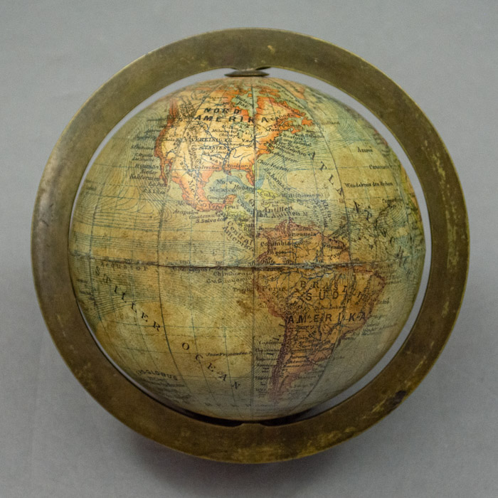
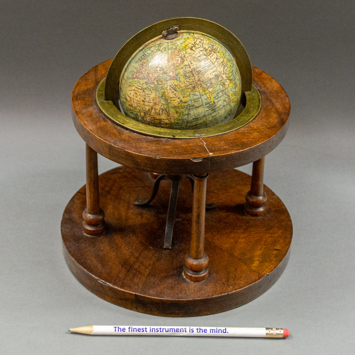
Description
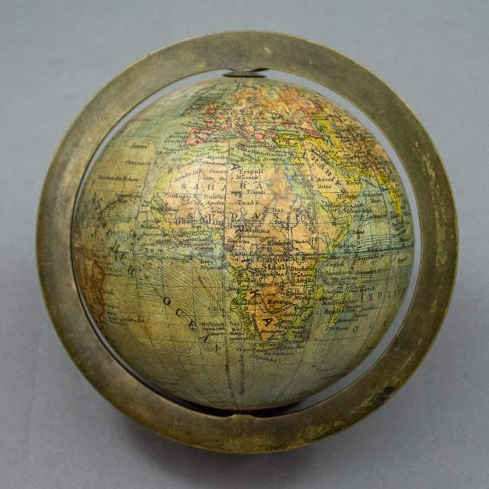
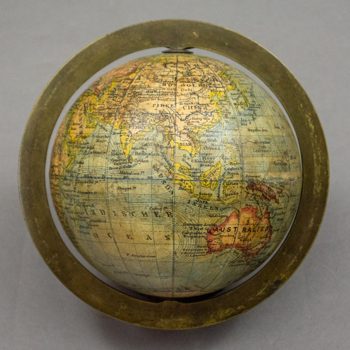
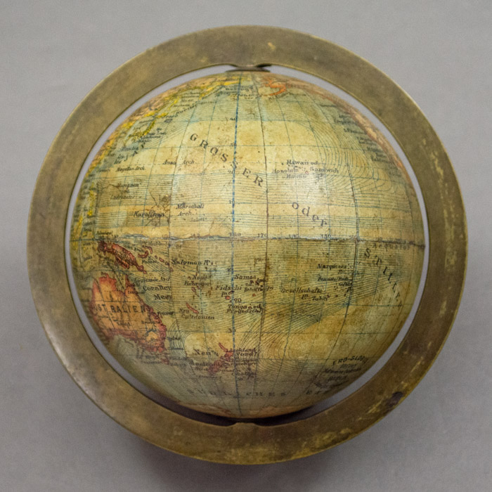
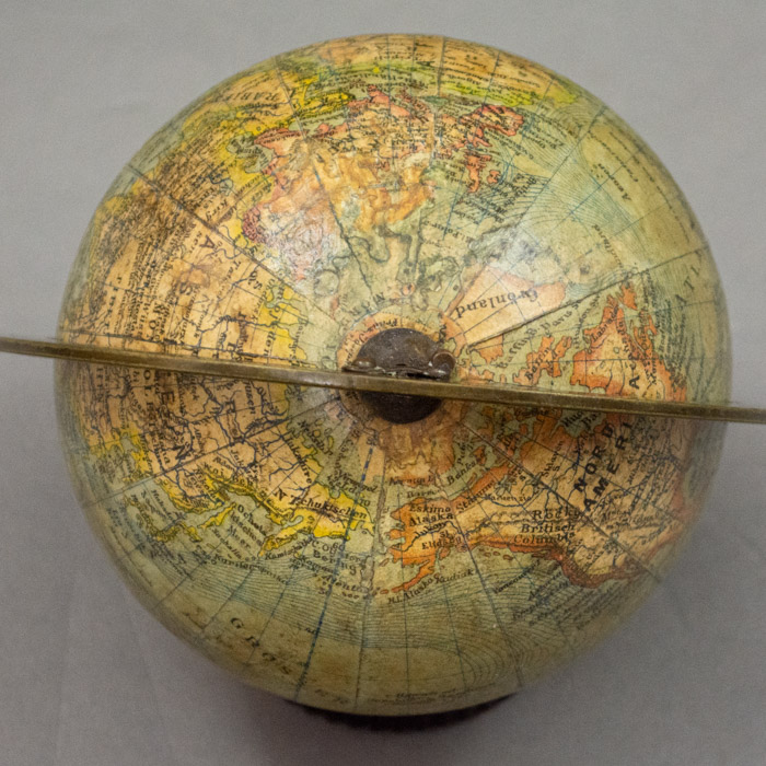
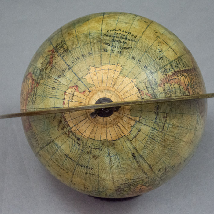
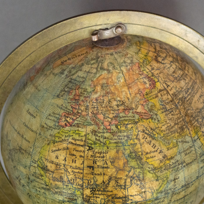
The globe, with place names in German printed in black, is comprised of 12 engraved hand-colored gores. The simple cartography labels continents, islands, oceans, and some major nations, cities and rivers. Some national boundaries are indicated by dotted lines. Major mountain ranges such as the Rocky Mountains are indicated by hatch lines. Oceans are blue-green, with ocean currents drawn as parallel blue lines. Land masses are tan, outlined with wide red, yellow, green and orange borders. Longitude and latitude lines and major rivers are printed in blue. The Equator and the antimeridian intersecting 180° latitude in the Pacific Ocean are heavier graduated and numbered blue lines. The Arctic and Antarctic Circles are dashed blue lines. Antarctica is outlined with a combination of solid lines and dotted ones that probably indicate areas where the accuracy of the mapping is uncertain.
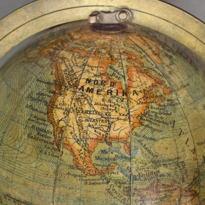
Some place names in midwest and western United States reflect curious –seemingly random — choices. For example, Galveston is named but Texas as such not named or indicated. St. Louis is named, but Missouri as such is not named or indicated, but rather appears to be shown to be part of a general region labelled Arkansas. Generally place names in these regions are sparse considering the globe is late 19th century.
Ludwig Julius Heymann was a prolific German globe maker based in Berlin. He began as a bookseller in Breslau in 1858 and moved the shop to Berlin in 1861. In 1883, he began producing globes under the company name Geographisch-artistische Anstalt [Geographic Artistic Institute] Ludwig Julius Heymann. Professor Henry Lange (1821-1893) was a longtime Heymann employee and designer of the gores. Heymann produced a wide range of terrestrial globes, from 5 cm to 36 cm in diameter, some of which were for export and thus in languages other than German. The stand styles ranged from simple wooden ones to elaborate decorative metal stands with sculptural figures supporting the globes. After Heymann’s death in 1899, the company was run by a succession of owners and moved to Leipzig around 1909. After World War I it issued some globes with Wagner and Debes. The company went out of business in 1930.
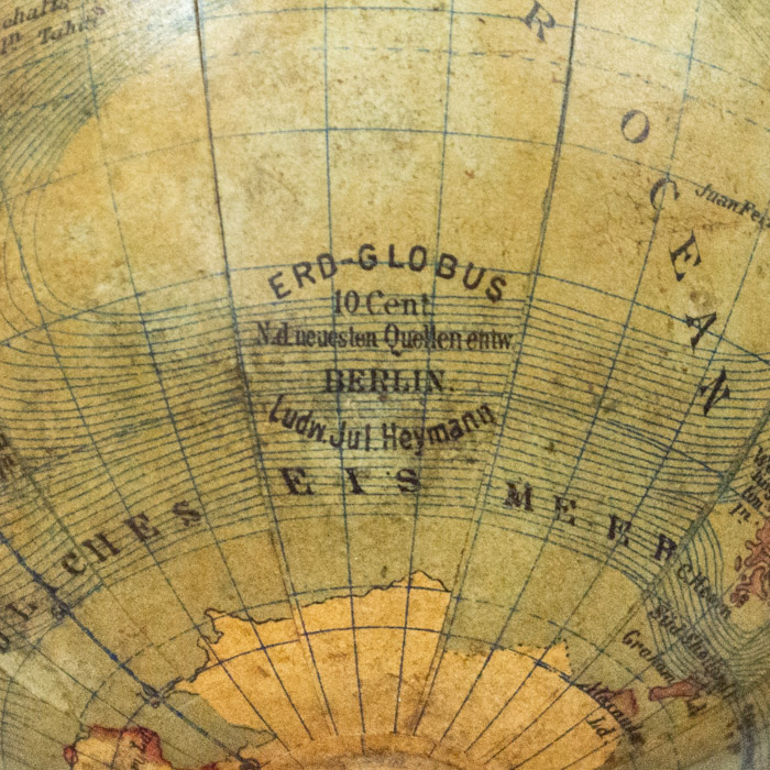
Cartouche: ERD-GLOBUS/ 10 Cent./ N.d. neuesten Quellen entw/ BERLIN,/ Ludw. Jul. Heymann
References:
Allmayer-Beck, Peter E., ed. Modelle der Welt: Erd-und Himmelsgloben — Kulturerbe aus oesterreichischen Sammlungen. [Models Of The World: Terrestrial And Celestial Globes — Cultural Inheritance from Austrian Collections.] Vienna: Bibliophile Edition/Christian Brandstaetter Verlagsgesellschaft, 1997. pp. 204-205, 213, 216.
“Geographisch-artistische Anstalt Ludwig Julius Heymann (1883-1930). Staatbibliothek zu Berlin. https://staatsbibliothek–berlin-de.translate.goog/die-staatsbibliothek/abteilungen/karten/sammlungen/bestaende/berliner-globen-1800-1955/heymann (1 September 2022).
Lamb, Tom and Collins, Jeremy. The World in Your Hands: An Exhibition of Globes and Planetaria. London: Christie’s, 1994. p. 101.


