Description
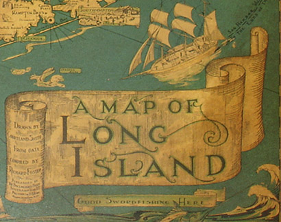
Courtland Smith was an architect in Southampton, Long Island, working at that occupation for a remarkable 70 years, until he retired at age 95. In that capacity, he designed buildings around the world, including many in the Hamptons, where his clean, uncluttered style strongly influenced local architectural standards. Nonetheless, according to Smith’s obituary in the Southampton Press, his best-known work was the pictorial Map of Long Island, initially suggested by his friend Richard “Dick” Foster, the map’s publisher, as a “keep-busy project when he was out of work during the Great Depression,” and which has remained “a steady seller in gift shops throughout Long Island for more than 75 years.” Foster is credited on the cartouche as having compiled the historical information. At the time of Smith’s death, the mayor of Southampton commented that over the years the map has served as a reminder to Long Islanders of the region’s history: “That map has had a significant impact on the development of not only Southampton, but all the other towns on Long Island that it features.”
Smith was born in Southampton and returned to Long Island after graduating from the University of Pennsylvania with an architecture degree in 1929. For many years thereafter he worked at large New York architectural firms, followed by design work for which he traveled worldwide. Notable projects with which he was associated include the Houston Astrodome, the Distant Early Warning (DEW Line) radar defense system in the Arctic, and foreign aid projects for the U.S. Agency for International Development. After many years spent living abroad, he returned to New York City in 1966, and moved to Southampton full-time in 1975, where he mentored younger architects in the architectural firm Pospisil & Brown, and actively participated in community and civic organizations.
The precise printing history of Courtland Smith’s A Map of Long Island is not academically known. The original edition of this map has a copyright of 1933 in the title cartouche. The copyright was updated in 1961, with examples instead bearing the copyright “1933, 1961” in the cartouche. This was a very popular map – at one point apparently sold at Jones Beach – and one that based on anecdotal experience a large number of people who grew up in Long Island from 1933 and on nostalgically recall having in their houses. Different colorations characterized by color tones, density and saturation of the 1933 maps indicate that between 1933 and before 1961 the map presumably was variously reprinted. For the same reason, between 1961 and possibly to present, the 1961 copyright version – also with variations in color – was also variously reprinted. For example, some examples of the map are characterized by light blue and cream tones, and others with more orange, especially in the borders. Differences have also been observed in thickness and type of paper on which the map is printed. Discerning differences is complicated by the fact that some of the maps fade over time from exposure to sun – a possibly alternate explanation for color variances. Examples bearing only the 1933 copyright are considerably rarer on the market place than those with the additional 1961 copyright and considered more valuable.
Condition: Varies with each one, as available. Most generally very good with the usual overall light toning, soiling, wear. Some mounted to board as issued. Some very fine overall with little wear. This map is shown above in an original plain wooden frame. Most examples we encounter are not framed. Availability at our gallery of examples in original frames for sale thus varies.
Reference:
“Obituary for Courtland Smith.” The Southampton Press. 10 March 2005. http://www.southamptonpress.com/inc/obits.ihtml?caption=&is=0310&imgObits=03-10-05.gif (2005).


