


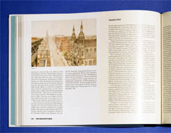


Description
The George Glazer Gallery loaned several maps and views of Manhattan to the Museum of the City of New York for the special exhibition The Greatest Grid: The Master Plan of Manhattan, 1811-2011, celebrating the 200th anniversary of the plan laying out the streets of the city and how it developed over the 19th and 20th centuries. The maps and views are also reproduced and described in the accompanying exhibition book. Historian Hilary Ballon of New York University served as guest curator and as lead author and editor of the book.
Most of the items on display were lent by libraries, museums and archives; the George Glazer Gallery is the only antiquarian map dealer among the lenders. All of the works we lent are featured on this webpage, some photographed at the exhibition. Click on the images or links for more information about individual items, which will be available for purchase after the exhibition closes. We have a few maps available at the George Glazer Gallery similar to ones from other lenders in the Greatest Grid exhibit, as another chance to buy a museum piece from us. See them here.


