
Description
Another example of this map is in the Museum of the City of New York’s collection, offering a rare glimpse into how New York once imagined its northern frontier. They describe the map online as follows:
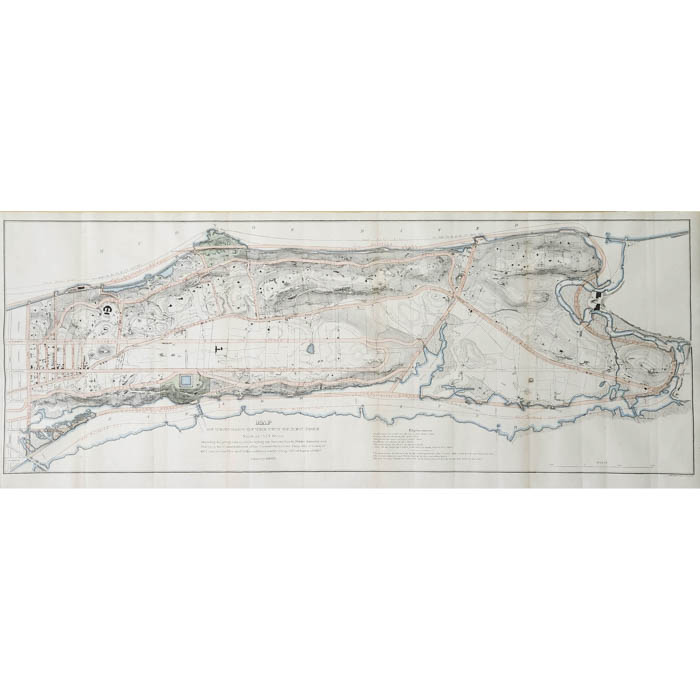
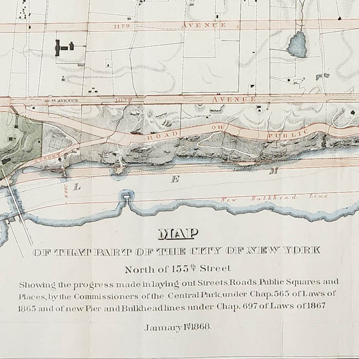
Contrary to the commissioners’ expectations, by mid century it was necessary to plan the area north of 155th Street. In 1860 the state legislature created the Washington Heights Commission to develop a plan. They created an elaborate topographical survey and map, but no definitive plan was presented. Finally, in 1865, the legislature transferred the Washington Heights Commission’s authority to Andrew H. Green’s Central Park Commission, and things began to move. This map of 1868 records Green’s preliminary scheme. It is a compromise between the vision of 1811 and the rocky realities of uptown topography. A rectilinear grid fills the flatlands, but angled and curving streets run around the hills. Green also created two new scenic waterside parks, today’s Fort Washington Park and part of High Bridge Park, and redrew the bulkhead line so that the island’s edge could be extended to accommodate a road along the shoreline.
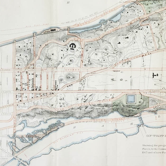
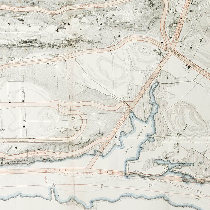
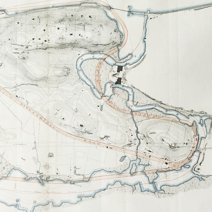
As a continuation of 1811 Commissioner’s Plan for the development of Manhattan south of 155th Street, this map envisioned the extension of the street grid into the Island’s still-rural northern reaches. In the map, Tenth and Eleventh Avenues are projected uptown as key arteries, with a proposed River Street to encircle Manhattan’s edge. Kingsbridge Road — later an extension of Broadway — features prominently, alongside crossings at Kings Bridge and Fordham Bridge. True to the ethos of Central Park, the Commissioners balanced infrastructure with preservation, incorporating parks and scenic viewpoints throughout the plan. This 1868 map was revised in subsequent Annual Reports. Indeed, the rugged topography of upper Manhattan defied the rigid grid, and later planners favored adapting to the landscape over imposing geometry. Still, there are key elements of this blueprint that are still present today such as the greenery on the West Side – now Inwood Park — and Tenth and Eleventh Avenues (now known as St. Nicholas and Amsterdam Avenues).
Napoleon Sarony (1821-1896) was a Canadian-American lithographer, publisher, and pioneering photographer based in New York City. He began his career as a lithographic artist and co-founded the influential firm Sarony, Major & Knapp, known for producing high-quality maps, advertisements, and prints in the mid-19th century. Though not a cartographer himself, Sarony’s firm published official city documents, including detailed urban planning maps for the Central Park Commission, in addition to a wide variety of historic prints. Later in life, he gained fame as a theatrical and celebrity photographer, capturing iconic portraits of figures like Oscar Wilde and Sarah Bernhardt. Sarony is remembered as a key figure in the visual culture of Gilded Age America.
Full Title:
Map of that Part of the City of New York North of 155th Street Showing the progress made in laying out Streets, Roads, Public Squares and Places, by the Commissioners of the Central Park, under Chap. 565 of Laws of 1865 and of new Pier and Bulkhead lines under Chap. 697 of Laws of 1867.
Explanation Key:
Road ways and paths are shown in fine dotted lines.
Fence walls are shown in fine solid lines.
Other fences are shown in heavy dotted lines.
Dwellings are shown in solid black.
Other buildings are shown in shaded black.
Note; All foregoing is taken from surveys made prior to December 1865.
The Street and Roads laid out by the Commissioners of the Central Park are shown by red lines and color.
The Public Squares and Places laid out by them are colored green.
The new Pier and Bulkshead lines laid out by them are indicated by words and lines in red color.
Condition: Generally very good, recently professionally cleaned and deacidified and laid on mulberry paper to flatten original folds, as issued, now with light remaining overall toning and wear.
References:
“Map of that part of the city of New York north of 155th street…” University of Wisconsin Milwaukee. https://collections.lib.uwm.edu/digital/collection/agdm/id/21709/ (12 May 2025).
“North of Central Park.” The Greatest Grid. https://thegreatestgrid.mcny.org/greatest-grid/north-of-central-park/280 (12 May 2025).
“Annual Report of Manhattan Central Park.” Digital Collections New York Public Library. https://digitalcollections.nypl.org/items/b958d1d0-6cdd-0131-658c-58d385a7bbd0 (12 May 2025).
“Annual Report Manhattan Central Park 1969.” New York City Government. https://www.nyc.gov/html/records/pdf/govpub/3999annual_report_manhattan_central_park_1869.pdf (12 May 2025).


