John Lodge (d. 1796) (engraver)
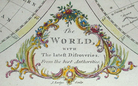
The World, With The latest Discoveries, From the best Authorities
London: Late 18th Century
Hand colored engraving
13.25 x 21.25 inches, overall
11.75 x 20.5 inches, plate mark
Sold, please inquire as to the availability of similar items.

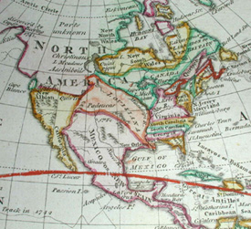
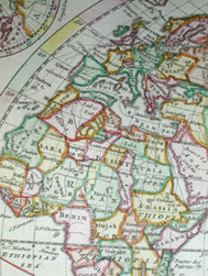
Double-Hemisphere World Map
John Lodge, Late 18th Century
John Lodge, Late 18th Century
This item is sold. It has been placed here in our online archives as a service for researchers and collectors.
- Please inquire as to the availability of similar items currently in stock, or use the navigation bar above to browse our site for currently available items.
- Find guidelines for the use of images from georgeglazer.com.
- To see more archived items, view our directory.
- Find information about selling your art and antiques.

 |
 |
 |
 |
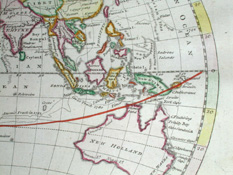 |
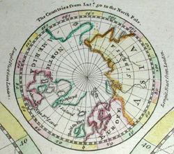
Late 18th-century double hemisphere world map showing countries and colonies. The explorers' routes of Cook and Anson are marked and dated. The cartouche is in an ornate rococo style, with a floral and vine motif. A small inset hemispheric map appears in the top center showing the world from 50 degrees Latitude to the North Pole. Lines of latitude are also noted on the principal map.
The engraving is by John Lodge, active in London c. 1754-94, who engraved maps for Gentleman's Magazine from 1754 to 1772 and Political Magazine from 1780 to 1790, as well as for many other works. He also engraved portraits and at least one satirical print.
Reference:
Maxted, Ian. "The London book trades 1775-1800: a preliminary checklist of members: John Lodge." Exeter Working Papers in British Book Trade History. 20 June 2001. http://www.devon.gov.uk/library/locstudy/bookhist/lonl.html (19 December 2003).