J. Morrison Murray (publisher)
Henry Cuthbert Tunison (additional publisher)
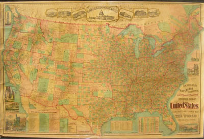
Murray's Matchless Historical County, Railroad, Distance and Index Map of the United States, and Illustrated Reference Map of the World
J. Morrison Murray, Elizabeth, New Jersey: 1883 (copyright 1882)
Two-sided map on wood rollers, lacquered one side
38 x 60 inches
Sold, please inquire as to the availability of similar items.

Double Sided Map on Rollers
J. Morrison Murray, 1883
J. Morrison Murray, 1883
This item is sold. It has been placed here in our online archives as a service for researchers and collectors.
- Please inquire as to the availability of similar items currently in stock, or use the navigation bar above to browse our site for currently available items.
- Find guidelines for the use of images from georgeglazer.com.
- To see more archived items, view our directory.
- Find information about selling your art and antiques.
 |
 |
 |
 |
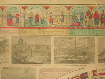 |
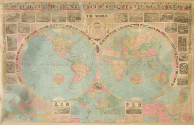
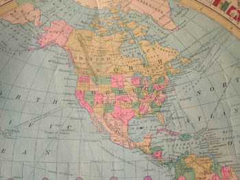
Large wall map of the United States (and Canada) in bold, bright colors. This is a two-sided map with a richly detailed “Illustrated Reference Map of the World” verso. The detailed geographical information on the U.S. map includes all the counties outlined, Indian Territory showing the individual tribal lands and engraved vignettes of national landmarks. The world is displayed in two hand-colored hemispheres, surrounded by charts, inset maps, engravings of important places and buildings, examples of national dress, flags of the nations, the solar system, and more.
The extensive reference data includes state and territorial statistics, populations of cities and towns, a chronological table of important events in U.S. history beginning with the Hugenot Colony in Carolina in 1562 until the assassination of President Garfield (“Nations Mourn”) in 1881. It also lists the annual salaries of U.S. Civil Officers -- President, $50,000; Vice President, $8,000; Chief Justice of the U.S. Supreme Court, $10,500 – as well as the annual salaries of U.S. Military and Naval Officers, e.g. Chaplains, $1,500.
Indian Territory tribal lands shown include Cheyennes & Arrpahoes (sic), Osages, Cherokees, Cree, Sac and Fox, Choctaw Nation, Chickasaw Nation, Kiowas, Comanches and Apaches Along the top are vignettes of important government buildings, including the White House, U.S. Treasury, U.S. Capitol, Mount Vernon and more. Engraved vignettes of national landmarks include West Point, Brooklyn Bridge,Bunker Hill Monument, Pike’s Peak, Mount of the Holy Cross, Yosemite Falls, Sequoias,Yellowstone, Giantess Geyser.
Full Title (with subtitle description) of World Map: “The Illustrated Reference Map of the World, for Students, Business Men and Families, showing the political divisions, chief cities, standards, costumes, architecture, coins, natural scenery and native animals—recording routes of discovery on sea and land to the present date, the degrees of heat and cold, the distribution of races and present prevailing religions of the globe, greatest ocean depths, etc.—giving the form of government, area, population, capital and chief exports of every country—illustrating celebrated palaces, cathedrals, places, etc. Published by J. M. Murray, Elizabeth, New Jersey.”