
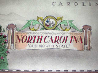
Pictorial Map of North Carolina
Karl Smith: 1934
Karl Smith: 1934
This item is sold. It has been placed here in our online archives as a service for researchers and collectors.
- Please inquire as to the availability of similar items currently in stock, or use the navigation bar above to browse our site for currently available items.
- Find guidelines for the use of images from georgeglazer.com.
- To see more archived items, view our directory.
- Find information about selling your art and antiques.

 |
 |
 |
 |
North Carolina
Louisville, Kentucky: 1934
Watermark: “Patten Rag 1/4 Text”
Photo process print
13.25 x 22.75 inches, image
16.5 x 25 inches, overall
Sold, please inquire as to the availability of similar items.
To see other maps by Karl Smith, type his name into our search engine.