N. Jane Phelps, Rochester, NY (artist)
James G. Riggs, Oswego, NY (compiler)
Josephine W. Wickser, Buffalo, NY (adviser)
Strecher-Traung, Rochester, NY (printer)
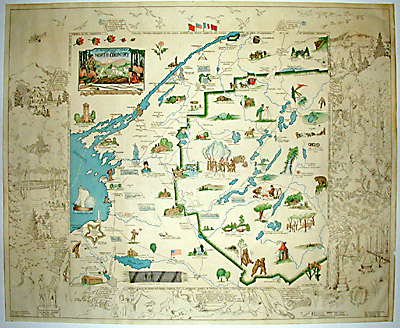
Pictorial and Historical Map of Northern New York
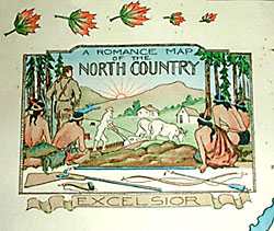
[A Romance Map of the North Country]
Rochester Museum of Arts and Sciences, Arthur C. Parker, Director, Rochester, NY: 1935
18 x 22 inches
Sold, please inquire as to the availability of similar items.

Northern New York
Pictorial & Historical Map, 1935
Pictorial & Historical Map, 1935
This item is sold. It has been placed here in our online archives as a service for researchers and collectors.
- Please inquire as to the availability of similar items currently in stock, or use the navigation bar above to browse our site for currently available items.
- Find guidelines for the use of images from georgeglazer.com.
- To see more archived items, view our directory.
- Find information about selling your art and antiques.
 |
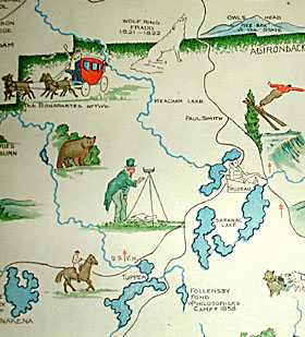 |
Pictorial map of Adirondack region illustrating famous places, persons, historical events, as well as flora and fauna. For example, a skier and skater are shown at Lake Placid; Major General Jacob Brown, Commander of American Forces in the War of 1812, is shown outside Watertown; bears are shown playing in the woods; campers are shown preparing bacon and coffee; etc. The outer border has additional line illustrations including Peace Treaty Between Sir William Johnson and Pontiac, August 25, 1766, a beaver, raccoon, and other animals in natural settings, etc.