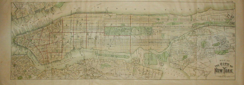
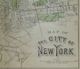
Map of the City of New York
Roger Sherman: 1884
Color printed lithograph
10.5 x 29.5 inches, overall
9.25 x 26.25 inches, image
Sold, please inquire as to the availability of similar items.

Map of the City of New York
Roger Sherman: 1884
Roger Sherman: 1884
This item is sold. It has been placed here in our online archives as a service for researchers and collectors.
- Please inquire as to the availability of similar items currently in stock, or use the navigation bar above to browse our site for currently available items.
- Find guidelines for the use of images from georgeglazer.com.
- To see more archived items, view our directory.
- Find information about selling your art and antiques.
 |
 |
 |
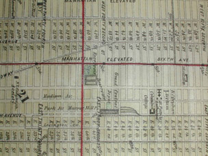 |
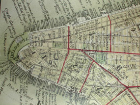
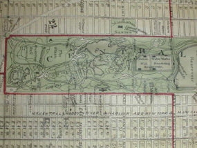
Map of the city predominantly showing Manhattan, along with portions of Jersey City, Hoboken, Brooklyn, the Bronx, and Long Island City. Each street in Manhattan is depicted from Battery Park to 206th Street, as well as all piers, parks and railroads. The city is divided into wards by a red line. The rendition of Central Park is rather detailed, featuring all bodies of water and various walkways. Formerly folded and included in a book or publication of the period.