Arthur S. Tuttle (editor)
Office of the President – Borough of Manhattan
American: 1924 copyright, corrected and published April 1940
Offset process print
18.5 x 60.5 inches, printed border
20.5 x 63 inches, overall
Sold, please inquire as to the availability of similar items.

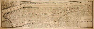
Large New York City Map
Manhattan -- 1940
Manhattan -- 1940
This item is sold. It has been placed here in our online archives as a service for researchers and collectors.
- Please inquire as to the availability of similar items currently in stock, or use the navigation bar above to browse our site for currently available items.
- Find guidelines for the use of images from georgeglazer.com.
- To see more archived items, view our directory.
- Find information about selling your art and antiques.
 |
 |
 |
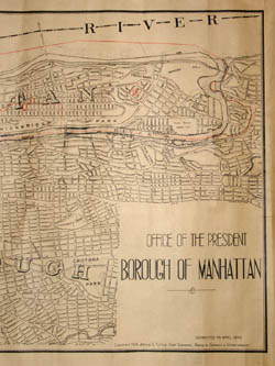 |
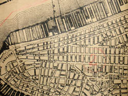
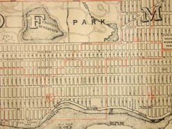
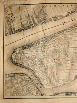
Large survey map of Manhattan rendered in great detail showing individual streets, institutions, and parks. Central Park appears prominently in the center with its major pathways and reservoirs. Shipping piers and associated rail yards are shown in detail. Other parts of New York City and the New York metropolitan area that are depicted include the lower Bronx, Randall’s and Ward’s Islands, Sunken Meadow, Roosevelt Island (shown as "Welfare Island"), Queens, Brooklyn, Hoboken and Jersey City.
The map has manuscript orange pencil lines, probably of the period, denoting the borough’s state assembly districts. Therefore it may be assumed that this was a “working” map used by a government official.
Arthur Smith Tuttle was the chief engineer overseeing the map’s survey, serving on the city’s Board of Estimate and Apportionment. In 1935, he also served as the president of the American Society of Civil Engineers, which today offers a memorial scholarship in his name.
Reference:
"Roster of Presidents." American Society of Civil Engineers. http://www.asce.org/150/presidents.html (11 October 2005).