J.B. Beers & Co.
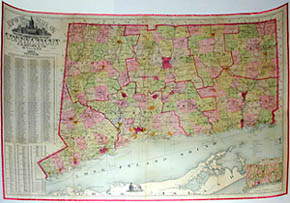
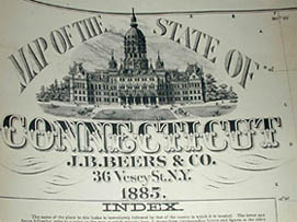
Map of the State of Connecticut
New York: 1885
Hand-colored lithograph
32.25 x 45.5 inches, image
34 x 47 inches, overall
Sold, please inquire as to the availability of similar items.

Map of the State of Connecticut
J.B. Beers & Co., 1885
J.B. Beers & Co., 1885
This item is sold. It has been placed here in our online archives as a service for researchers and collectors.
- Please inquire as to the availability of similar items currently in stock, or use the navigation bar above to browse our site for currently available items.
- Find guidelines for the use of images from georgeglazer.com.
- To see more archived items, view our directory.
- Find information about selling your art and antiques.
 |
 |
 |
 |
 |
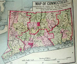 |
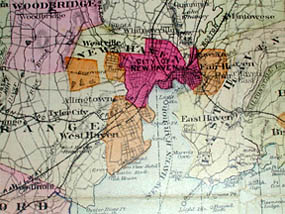
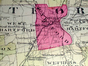
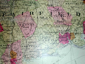
Large detailed wall map of Connecticut. Connecticut counties and other geographic entities colored in various shades of yellow, pink, green, and blue. Roads, railroads, rivers, and raised topography depicted. Important cities and towns labeled. Key with symbols representing the state capital, county seats, post offices, rail road stations, villages, state lines, county lines, town lines, and natural oyster beds. Index providing town names, the counties they are in, and where they can be found on the map grid. Table of senatorial districts, each with a date of founding and population. Small inset map lower right illustrating congressional districts of the state. An engraved view of Old Stone House, said to be the oldest house in the United States, center of lower margin. View of New Capitol at Hartford surmounting cartouche. Also shows Long Island Sound and some northern portions of Long Island.
Full publication information: J.B. Beers & Co., 36 Vesey St., New York