Trans-Alaska Pipeline Relic Map
American: c. 1975-1977
Cut steel pipe
18 x 17 inches overall, approximately
Sold, please inquire as to the availability of similar items.

Trans-Alaska Pipeline
Relic Map, c. 1975-77
Relic Map, c. 1975-77
This item is sold. It has been placed here in our online archives as a service for researchers and collectors.
- Please inquire as to the availability of similar items currently in stock, or use the navigation bar above to browse our site for currently available items.
- Find guidelines for the use of images from georgeglazer.com.
- To see more archived items, view our directory.
- Find information about selling your art and antiques.

 |
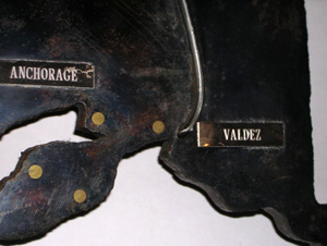 |
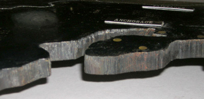
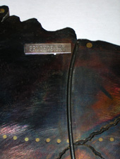
Relic map of Alaska cut by the Supervisor of Welders from a section of steel pipe used to construct the Alaska Oil Pipeline. The original pipe used was 1/2 inch thick and 48 inches in diameter, with each section being 40 feet long. The map shows the entire state of Alaska with engraved plates labeling the cities Prudhoe Bay, Fairbanks, Anchorage, and Valdez. The pipeline is shown as an attached rod of metal running from Prudhoe Bay (where the oil is extracted) to Valdez (where it was loaded to tankers for shipment).
Since June 20, 1977, the Trans-Alaska Pipeline System has connected the oilfields in northern Alaska to the seaport at Valdez where the oil is shipped to the continental United States for refining. The 48-inch diameter pipeline runs 800 miles. Construction took about two years, and was difficult and dangerous due to the extreme arctic climate of Alaska.
Reference:
"Trans-Alaska Pipeline System." Asinah.net. 2004. http://alaska.asinah.net/en/wikipedia/t/tr/trans_alaska_pipeline_system.html (28 April 2004).