Pieter Van der Aa (1659-1733)
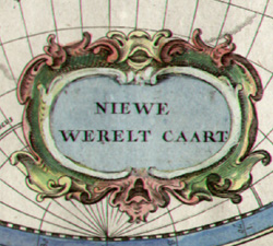
Nova Delneatio Totius Orbis Terrarum/ Niewe Werelt Caart
[New World Map]
Leiden: Early 18th Century
Hand-colored copperplate engraving
10.25 x 13.25 inches, platemark
11.5 x 15 inches, overall
Sold, please inquire as to the availability of similar items.

Dutch Double Hemisphere World Map
Pieter Van der Aa, Early 18th Century
Pieter Van der Aa, Early 18th Century
This item is sold. It has been placed here in our online archives as a service for researchers and collectors.
- Please inquire as to the availability of similar items currently in stock, or use the navigation bar above to browse our site for currently available items.
- Find guidelines for the use of images from georgeglazer.com.
- To see more archived items, view our directory.
- Find information about selling your art and antiques.

 |
 |
 |
 |
 |
 |
 |
 |
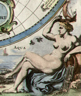 |
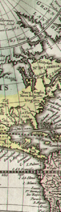
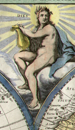
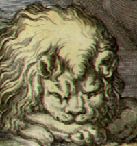
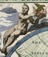
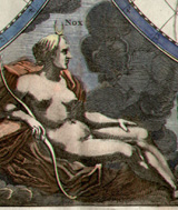
Double-hemisphere world map, richly decorated with six allegorical nude or draped female figures representing Day and Night in the center, and the four elements of Fire, Air, Earth and Water in the spandrels. California is shown as an Island and the Great Lakes are not shown. The story of maps that showed California as an island began with a mistaken journal entry by a Spanish explorer in 1602, and even though some 100 years later another explorer concluded that California was attached to the continent, it took a royal edict by King Ferdinand VI of Spain to establish that as fact.
As is often the case with 17th and 18th century maps, this plate came out under the imprint of several different publishers over a period of many decades. It was originally published c. 1655 by Arnold Colom in one of the early world maritime atlases to be produced by a Dutch firm. The map also found its way into some editions of his father Jacob Colom’s Werelts-Water-Deel (1663). Later Frederick de Wit reissued it with a re-engraved title, and updated the cartography. Hendrik Doncker in turn included the de Wit version in his Zee-Atlas of the mid 1670s. Meanwhile, in 1660, J.L. Gottfried published a reduced-size version combining Colom’s figures with maps engraved by Jacob van Meurs. In the early part of the 18th century, Van der Aa reissued Meurs plate, which is the version offered here.
Pieter Van der Aa was a Dutch map publisher. His major work was the massive Galerie Agréable du Monde (1729) a compendium of some 3,000 plates in 66 volumes, published in an edition of 100 sets. Other publications included Atlas Nouveau et Curieux and Atlas Nouvel, both produced in 1714. Van der Aa also produced separately issued maps and reissued maps by earlier engravers, such as Les Forces de l’Europe (1726), originally published in 1696 by Nicolas de Fer.
References:
“Pieter van der Aa.” http://en.wikipedia.org/wiki/Pieter_van_der_Aa (16 May 2006).
Shirley, Rodney W. The Mapping of the World:Early Printed World Maps 1472-1700. London: Holland Press, 1983. 395, 417, pl. 295.
Tooley, R.V. Maps and Map-Makers. 4th Ed. New York: Bonanza Books, 1970. pp. 35, 42.