Karl Smith
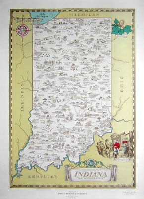
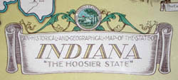
An Historical and Geographical Map of the State of Indiana “The Hoosier State”
Karl Smith, Louisville: July 1934
Compliments of John P. Morton & Company, Louisville
Represented by Charles F. Walton, Evansville, Indiana
Color photo process print
21.75 x 15.5 inches, image>
25.5 x 19 inches, overall
Sold, please inquire as to the availability of similar items.

Pictorial Map of Indiana
Karl Smith: 1934
Karl Smith: 1934
This item is sold. It has been placed here in our online archives as a service for researchers and collectors.
- Please inquire as to the availability of similar items currently in stock, or use the navigation bar above to browse our site for currently available items.
- Find guidelines for the use of images from georgeglazer.com.
- To see more archived items, view our directory.
- Find information about selling your art and antiques.
  |
  |
 |
To see other maps by Karl Smith on our site, use our site search engine.
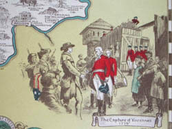
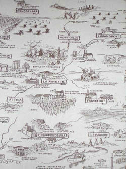
Pictorial map of the state showing various towns and cities throughout with accompanying illustrations. The images include various farm animals, farmland, railroads, universities, factories, and waterfalls. The cartouche features the state seal and a view of the Capture of Vincennes in 1779 appears to the right, taken from a painting. Apparently given as a promotional item by John P. Morton & Company, Louisville, Kentucky.
In the 1930s and 1940s, the Speed Art Museum (then the J.B. Speed Art Museum) in Louisville, Kentucky, commissioned Karl Smith to make a series of pictorial maps of the states.