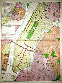
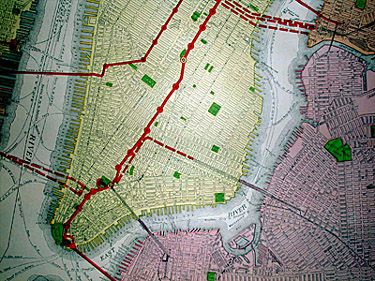
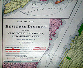
Map of the Business District of New York, Brooklyn, and Jersey City with Subway Lines
from Rand-McNally Indexed Atlas
Rand, McNally & Co., Chicago: 1909
Photo-process color engraving
28 x 21 inches
Sold, please inquire as to the availability of similar items.

Business Map of New York City
Rand McNally: 1909
Rand McNally: 1909
This item is sold. It has been placed here in our online archives as a service for researchers and collectors.
- Please inquire as to the availability of similar items currently in stock, or use the navigation bar above to browse our site for currently available items.
- Find guidelines for the use of images from georgeglazer.com.
- To see more archived items, view our directory.
- Find information about selling your art and antiques.
 |
 |
 |
 |
Map of Manhattan and immediate surrounding areas. Inset map of "Greater New York" depicts the five boroughs and Jersey City. Colored brightly in pink, green, red, peach, and yellow. This is a relatively early map of the New York City subway system, which officially opened in October 1904. Broken red lines indicate subways and tunnels under construction, and completed subway routes and stops are indicated in solid red.