William S. Swift & Son
Swift’s Map of Martha’s Vineyard
Vineyard Haven, Massachusetts: Early 20th Century
Cyanotype print
15.25 x 25.5 inches, overall
Sold, please inquire as to the availability of similar items.

Swift's Map of Martha's Vineyard
Cyanotype print, Early 20th Century
Cyanotype print, Early 20th Century
This item is sold. It has been placed here in our online archives as a service for researchers and collectors.
- Please inquire as to the availability of similar items currently in stock, or use the navigation bar above to browse our site for currently available items.
- Find guidelines for the use of images from georgeglazer.com.
- To see more archived items, view our directory.
- Find information about selling your art and antiques.
 |
 |
 |
 |
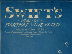 |
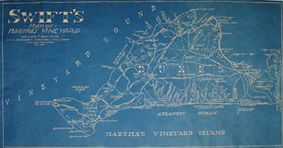
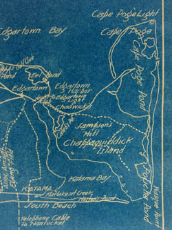
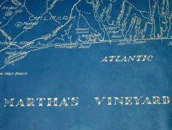
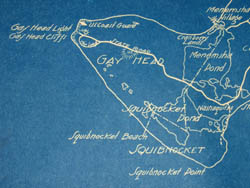
Map of Martha’s Vineyard, Massachusetts, showing town divisions, major roads, ponds, beaches, lighthouses, and elevations above sea level. The island is labeled in large letters with the name of the county -- Dukes. Issued by William S. Swift & Son, Civil Engineers, Surveyors and Real Estate, it was printed in cyanotype, commonly referred to as “blueprint,” as a reversal, with the lines the color of the paper, and the surrounding shapes in blue.
William S. Swift (1861-1936) was the longtime town clerk of Vineyard Haven, in addition to having been a civil engineer and surveyor. He spent his entire life there.
References:
Baer, C., ed. Index to Deaths in Tisbury 1920 - 1960. Historical Records of Tisbury, Massachusetts. 1997. http://history.vineyard.net/deaths2i.htm (1 February 2006).
Baer, C., ed. Index to the 1870 Federal Census of Tisbury, MA. Historical Records of Tisbury, Massachusetts. 1995. http://history.vineyard.net/cen70.htm (1 February 2006).
Baer, C., ed. "South Main St., Spring St., and Centre St. as remembered by Stan Lair, 1979." Historical Records of Tisbury, Massachusetts. 1996. http://history.vineyard.net/sthmain.htm (1 February 2006).