H. McIntyre (cartographer)
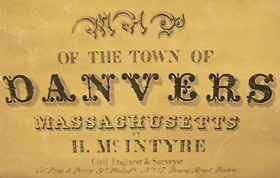
Map of The Town of Danvers, Massachusetts
H. McIntyre Civil Engineer & Surveyor, Pine & Perry Streets Philadelphia, No. 17 Doane Street, Boston: 1852
Friend & Aub, 80 Walnut Street, Philadelphia (lithographers)
Wagner & McGougan, Philadelphia (printers)
Hand colored engraving on wooden rollers, varnished, backed on linen
36 x 27.5 inches (map sheet without rollers)
Sold, please inquire as to the availability of similar items.

Map of the Town of Danvers, Massachusetts
H. McIntyre: 1852
H. McIntyre: 1852
This item is sold. It has been placed here in our online archives as a service for researchers and collectors.
- Please inquire as to the availability of similar items currently in stock, or use the navigation bar above to browse our site for currently available items.
- Find guidelines for the use of images from georgeglazer.com.
- To see more archived items, view our directory.
- Find information about selling your art and antiques.
 |

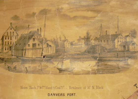 |
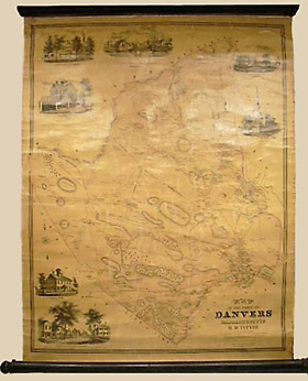
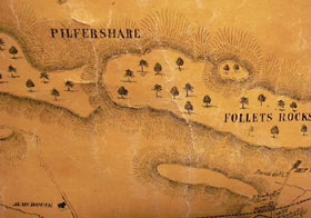
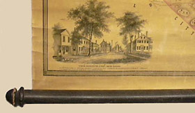
Detailed map of the town of Danvers, Massachusetts, in the mid 19th century, at scale of four inches to a mile. The maps includes seven engraved vignettes of the more prominent buildings in the town: the Third Congressional Church in Danvers Plains; Danvers Alms House in South Danvers; Moses Black, Jt & Co. Wood & Coal Yd; Residence of Mr. M. Black in Danvers Port (with sailboats in the harbor); Naumkeag House in North Danvers; H.B. Wards Residence on Elm Street in South Danvers; C. Thompson's Residence on Washington Street in South Danvers; and a view on Washington Street. Mount Pleasant and Waldens Hill are also shown. Some light pink and green shading and outline color.
Danvers is in northeastern Massachusetts, bordered by Salem and about 17 miles north of Boston. It was officially established as a district in 1752. At the time this map was produced, it was a thriving industrial, commercial and cultural center. Its major industries were shipping, shipbuilding, leather tanning and the manufacture of bricks, carpes and shoes. Elegant country estates were built there and the authors John Greenleaf Whittier, Lucy Larcom, and Nathaniel Hawthorne frequented the area and wrote about it.
Norman Friend (b. c.1815) was a Danish-born lithographer who worked in Philadelphia from at least 1850-1871. With the Jewish-American lithographer Jacob Aub they established the firm Friend & Aub around 1851, and produced many town, county and railroad maps over the next decade. In 1861, Aub joined the Union Army, serving as quartermaster in the 5th regiment of the cavalry from Pennsylvania.
References:
"Civil War Database" Jewish-History.com. http://www.jewish-history.com/database.html (13 May 2003).
Trask, Richard B. "History." Danvers, Massachusetts. http://www.danvers-ma.org/history.htm (13 May 2003).
Young, William, Ed. A Dictionary of American Artists, Sculptors and Engravers. Cambridge, Massachusetts: William Young and Co., 1968. pp. 19, 178.