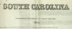
South Carolina
Joseph H. Colton, New York: 1854
Hand-colored engraving
14 x 16.5 inches, overall
5 x 3.5 inches, folded into cloth covers
as issued
Sold, please inquire as to the availability of similar items.

South Carolina
Colton Pocket Map, 1854
Colton Pocket Map, 1854
This item is sold. It has been placed here in our online archives as a service for researchers and collectors.
- Please inquire as to the availability of similar items currently in stock, or use the navigation bar above to browse our site for currently available items.
- Find guidelines for the use of images from georgeglazer.com.
- To see more archived items, view our directory.
- Find information about selling your art and antiques.
 |
 |
 |
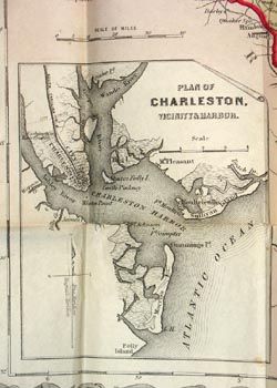 |
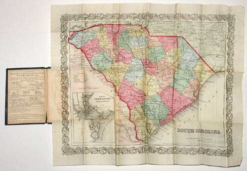
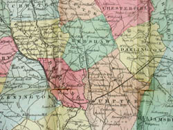
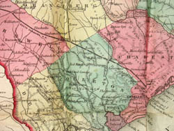
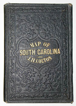
Folding pocket map of South Carolina by J. H.Colton showing the townships, counties, county seats, villages, railroads, canals and cities of the state. Raised topography and rivers depicted throughout. Hand-colored in tones of pink, yellow, blue and orange, with red outline, within the usual decorative vine border associated with Colton maps. An inset map of Charleston is lower left. Population census data is on verso. The inside front cover has advertisements for other cartography products by Colton & Co. and the outer cover is embossed with raised decoration, the title in gold.
Between 1831 and 1890, the Colton firm dominated American map publishing and their atlases were the finest produced in the U.S. during the 19th century. The company was founded by Joseph Hutchins Colton (1800-1893), who had no formal training in geography or cartography; he began by purchasing copyrights of maps prepared by other individuals or companies, and his principal role was to manage the production and distribution of the maps. His first maps were drawn by the esteemed cartographer David H. Burr in the 1830s. By the 1850s Colton was also publishing guidebooks, atlases and immigrant and railroad maps. The firm was renamed G.W. & C.B. Colton in the 1860s when Colton was succeeded by his sons -- George Woolworth Colton (1827-1901) and Charles B. Colton (c. 1831-1916). It is believed that George Colton compiled the company's 1855 Atlas of the World and served thereafter as the firm's principal map compiler, cartographer and engraver.
Joseph H. Colton sold his atlas plates to Alvin Jewett (A.J.) Johnson in 1860. Johnson, the publisher, is best known for his atlases, issued in many editions in the second half of the 19th century, beginning with the publication of Johnson's New Illustrated (Steel Plate) Family Atlas. In 1898, the G.W. & C.B. Colton firm became Colton, Ohman & Co. and published under that name until about 1901, when August R. Ohman began publishing under his own name as "successor to the Coltons."
Full publication information: Joseph H. Colton, 86 Cedar St. New York
References:
Cohen, Paul E. and Augustyn, Robert T. Manhattan in Maps: 1527-1995. New York: Rizzoli, 1997. p. 120.
Ristow, Walter W. American Maps & Mapmakers: Commercial Cartography in the 19th century. Detroit, MI: Wayne State University Press, 1985. pp. 325, 327.