


Description
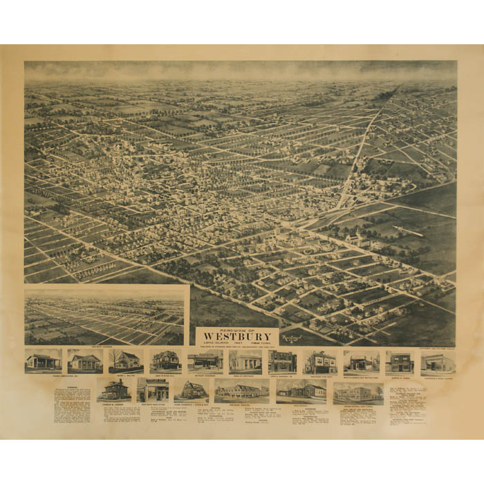
Rene Cinquin was a panoramic map artist active in the New York City metropolitan area during the 1920s. In the Introduction to the Library of Congress catalog Panoramic Maps of Cities in the United States and Canada (2nd ed., 1984), John Hébert and Patrick E. Dempsey list him among the “noteworthy” artists of the genre. During the 1920s, the firm of Hughes & Cinquin produced panoramic maps under the sponsorship of Oakley H. Bailey (1843-1947), an outstanding and prolific panoramic map artist and publisher credited with a few hundred such views. The Library of Congress has seven “Aero-Views” of Long Island towns and six of New Jersey towns in a similar vein to this view of Westbury, all drawn by Rene Cinquin between 1924 and 1929. Most were published by either Hughes & Cinquin, Brooklyn, or Metropolitan Aero-View Co., New York. Hébert and Dempsey say that between 100 and 250 copies of each Hughes & Cinquin aero view were published, and likely the same edition size holds for the one offered here. That may explain why we have found no others listed in public collections; we assume it is quite rare.
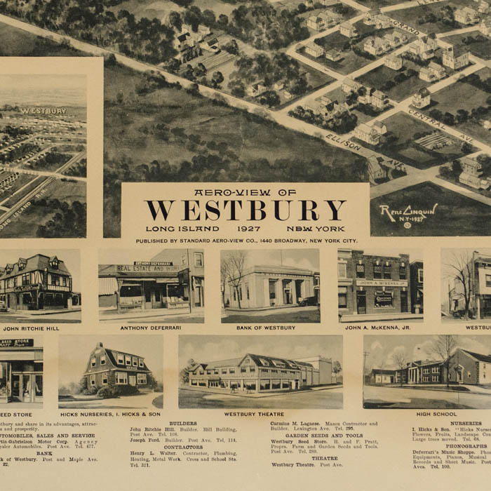
The village is described in the lower margin with this promotional text aimed at prospective homebuyers and business owners:
Westbury is in the region of the better class on Long Island and is a beautiful fast growing and prosperous village with excellent outlook for extensive development. Easily accessible to New York City by L. I. R. R. and has ample transit facilities to various points, good soil and climate conducive to health and best living.
The village has an excellent high school, grade schools and Parochial school; Robert Bacon Memorial Library for children; the Meeting Houses of the Society of Friends, Episcopal, Methodist and Roman Catholic Churches; a motor equipped Fire Department; well paved streets and sidewalks; a four-well artesian water plant, furnishing the finest water; gas; electricity; the Robert Bacon Post of the American Legion; Board of Trade; a Chapter of Masons with their new Temple; Knights of Columbus; Order of the Eastern Star; Catholic Daughters of America, a District nurse. There are two banks in the village each in a new modern building; Savings and Loan Association; a modern theatre; two coal yards; lumber yard; several large nurseries; and up-to-date stores, markets and shops.
The citizens are enterprising and hospitable and invite and will encourage the homeseeker or business man of like spirit to come to Westbury and share in its advantages, attractions and prosperity.
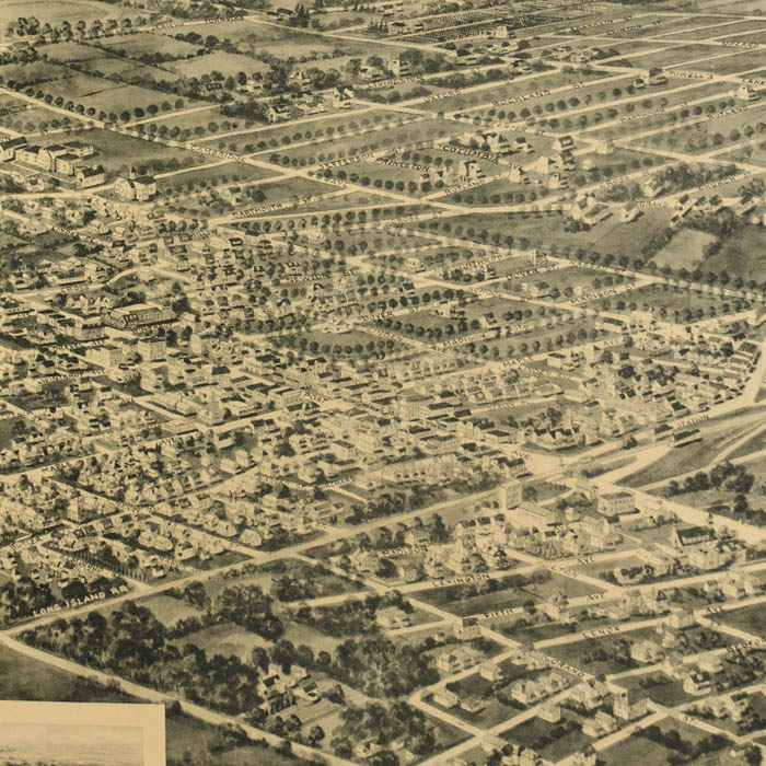
This map was issued at the end the heyday of drawn bird’s-eye views of American towns, which lasted from the Civil War to around 1910. Historians estimate that some 4,500 views were produced nationwide during that period. In an era before aviation, the creation of these panoramas was an act of imagination, combining information from city maps, ground-level sketches of buildings and the rules of Renaissance perspective into a convincing aerial view. Hand-drawn views were largely supplanted by aerial photographs from airplanes in the mid 20th century.
Full publication information: Published by Standard Aero-View Co., 1440 Broadway, New York City.
Condition: Generally very good, recently professionally cleaned, deacidified with some overall light remaining toning and wear. Few minor patches of discoloration. Backed on archival paper to restore a few marginal tears, one extending slightly into image; but all unobtrusive and most can be matted out.
References:
“Collection Items [Contributor: Cinquin, Rene].” Library of Congress Collection Panoramic Maps. https://www.loc.gov/collections/panoramic-maps/?fa=contributor:cinquin,+rene%7Clocation:new+york (13 May 2019)
Hébert, John R., ed., rev. by Patrick E. Dempsey. Panoramic Maps of Cities in the United States and Canada. 2nd ed. Washington, D.C.: Library of Congress, 1984. pp. 4, 8-9.