
Description
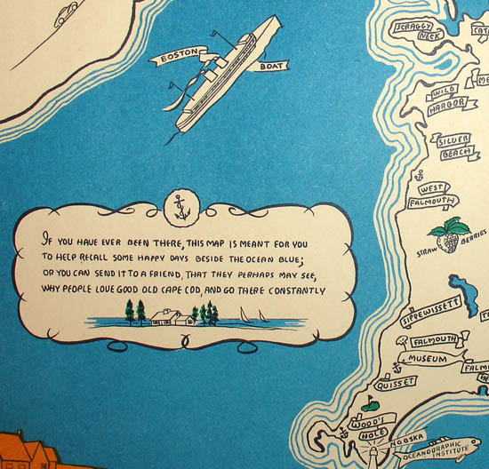
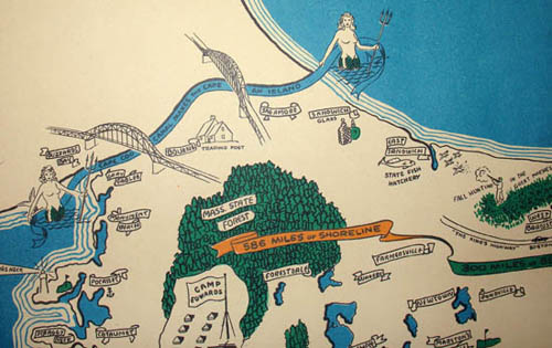
The map is printed in tones of blue, green and orange and black. It is enclosed within an orange border, decorated with drawings in a more naturalistic style of people enjoying sporting and recreational activities, illustrations of ocean fish and different types of sailboats, and depictions of ships of some early explorers and settlers including a Viking ship, the Mayflower, and the vessels of John Smith and Champlain. At the center of the bottom border, two seahorses flank a clamshell. An orange and green ribbon across the map gives some statistics: “586 Miles of Shoreline, 300 Miles of Beaches, 1000 Miles of Highway, As Many Miles of Byways, 300 Lakes.” A verse accompanied by a small landscape drawing in lower left corner reads:
If you have ever been there, this map is meant for you
To help recall some happy days beside the ocean blue;
Or you can send it to a friend, that they perhaps may see,
Why people love good old Cape Cod, and go there constantly.
Illustrated pictorial maps were popular souvenirs from the 1920s to 1960s. See our online exhibition About Pictorial Maps.
Inscription below border: “Get duplicates from your dealer — or send money order or check for $1.25 to Paul Paige, East Brewster, Mass.”
Condition: Generally very good with only minor overall toning and wear.
Reference:
“U.S. Route 6.” Wikipedia. 15 June 2013. https://en.wikipedia.org/wiki/U.S._Route_6 (27 June 2013).