


Description
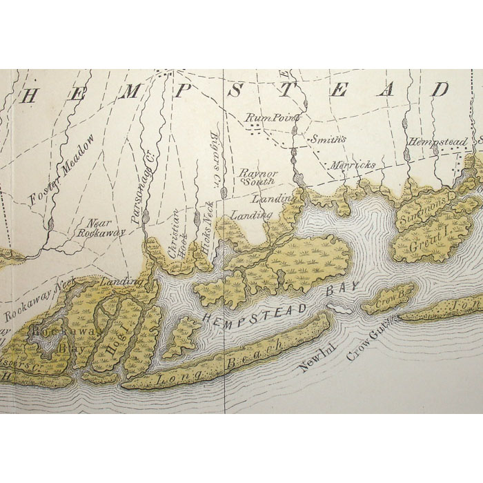
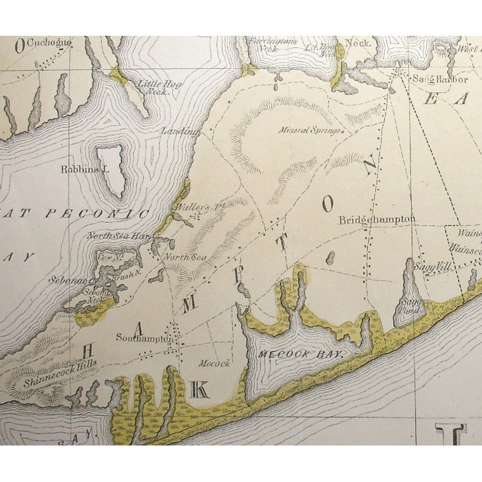
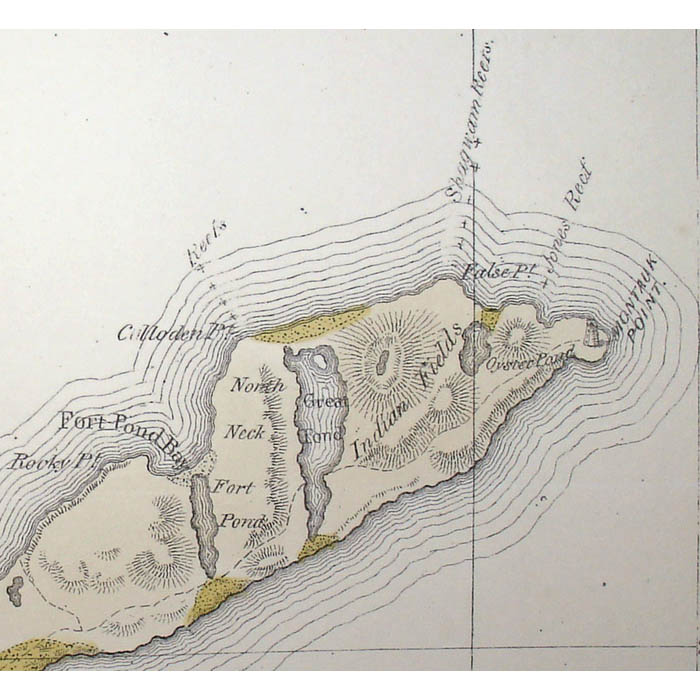
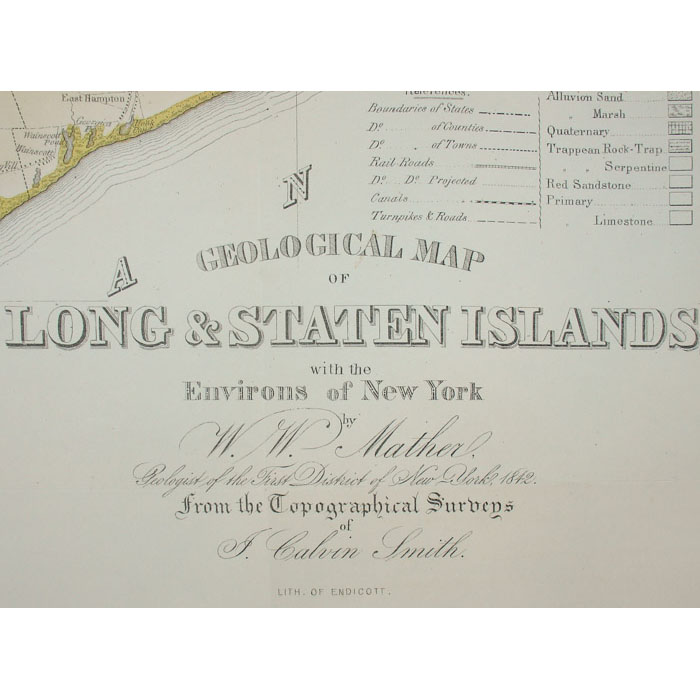
Long Island was among the first areas in the New World reached by European settlers. The town of Southampton on the eastern tip was settled in 1640. The island and its coast were mapped in the 18th century by the British up to the time of the Revolutionary War. The best-known sea charts were made for the British Admiralty by F.W. Des Barres. In the 19th century, a concerted effort began in the America to map the interior of the United States. This mid 19th century map was a joint effort by W.W. Mather, a geologist, and the surveyor J. Calvin Smith, also well known for his huge wall map of the State of New York. By the end of the 19th century, the Long Island Railroad was actively promoting development on the island, and issued many maps to encourage New York City residents to build houses and farms east of the city. The offered map shows what are now popular vacation locations on Long Island including West Hampton, East Hampton, Southampton, Bridgehampton, Sag Harbor, Amagansett, Montauk, Glen Cove, Jones Beach, and Fire Island.
William W. Mather was Professor of Natural History at Ohio University, and served as Geologist of the First Geological District of New York for Governor William H. Seward. In his introduction to the text accompanying the map, Mather thanks the Long Island community for its cooperation. He notes a humorous instance in which the owner of one Long Island farm assumed that the rocks Mather gathered from a nearby road must have contained gold, given the extreme care that Mather took in collecting and preserving the specimens, and therefore tried to prevent the geologists from taking them.
Throughout most of the 19th century, various members of the Endicott family operated firms in New York City specializing in lithography, engraving and printing, as well as the fine art and music business. Lithograph scholar Harry S. Peters notes that their prints were the first machine-made lithographs in mass production. The company was founded in 1828 and was a prolific publisher of all types of subject matter over the next 68 years, notably views and maritime scenes, but also including historical landmarks, battles and a variety of other subjects. George Endicott operated it under his own name from 1834 to 1844, and with William Endicott as G. & W. Endicott from 1845 to 1849. William continued the business under his own name after George’s death in 1849, joined by Francis Endicott in 1852. The last proprietor was George Endicott II, until 1896.
John Calvin Smith (1809-1890), a surveyor, geographer, cartographer, engraver, and publisher began working in New York in 1835. Along with George E. Sherman (born 1810/11), he founded Sherman & Smith, a prolific New York City map publisher from 1840 to 1853. Smith also worked with other cartographers and publishers including the New York City firms of John Disturnell and J.H. Colton, and he published numerous significant maps under his own name. He was a charter member of the American Geographical Society.
Condition: Generally very good, recently professionally cleaned and original folds professionally flattened and backed on Japanese paper, with only minor remaining toning, wear handling. Small portion of blank margin on left side, generally originally lacking on these maps, tipped in with matching paper. Some faint remaining irregular toning relating to original way map was folded, as typical. Can be sent rolled.


