John M. Atwood (engraver)
Map of the World, on Mercators Projection
T. & E.H. Ensign, New York: 1845 (publishers, revised edition)
Phelps & Ensign, New York: 1841 (copyright)
Hand-colored engraving, backed on linen, with rollers
33 x 45 inches, map excluding rollers
48 inches, top batten; 52 inches, bottom roller
Sold, please inquire as to the availability of similar items.

Map of the World, on Mercator's Projection
Mounted on rollers, T. & E.H. Ensign, New York: 1845
Mounted on rollers, T. & E.H. Ensign, New York: 1845
This item is sold. It has been placed here in our online archives as a service for researchers and collectors.
- Please inquire as to the availability of similar items currently in stock, or use the navigation bar above to browse our site for currently available items.
- Find guidelines for the use of images from georgeglazer.com.
- To see more archived items, view our directory.
- Find information about selling your art and antiques.

 |
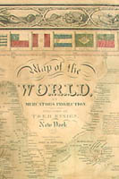 |
Wall map of the world on Mercator’s Projection. Each of the four corners is decorated with a rectangular vignette of one of the major continents, comprised of images of native peoples, flora, fauna, and an outline map. The border of repeating naturalistic sea shells surrounds a secondary border of flags of the world. Colored in tones of green, yellow, pink, red, and blue. The United States is shown with relatively early western cartography, including many territories. This is the 1845 revised edition of the map published by T. & E.H. Ensign, originally copyrighted by Phelps and Ensign in 1841.
The publishing firm Humphrey Phelps (also known as Phelps, Humphrey) operated in New York City from the 1830s to the 1850s, at various times co-publishing work with Ensign & Thayer. They produced maps, prints and books, and are known for the “Phelps Guides” series of folding maps and wall maps for travelers, which Phelps began producing in 1838. Timothy and Edward Ensign were partners in a New York City printing firm, active between 1841 and 1861. T. & E.H. Ensign also worked in association with other printers such as Humphrey Phelps, B.W. Thayer, the Kelloggs, and Bridgman & Fanning, producing prints and maps.
Reference:
Peters, Harry T. America on Stone. U.S.: Doubleday, Doran, 1931. pp. 181, 325.