

These items are sold. They have been placed here in our online archives as a service for researchers and collectors.
- Please inquire as to the availability of similar items currently in stock, or use the navigation bar above to browse our site for currently available items.
- Find guidelines for the use of images from georgeglazer.com.
- To see more archived items, view our directory.
- Find information about selling your art and antiques.
- NYC Maps 19th C.
- NYC Views 19th C.
- NYC Maps 20th C.
- NYC Views 20th C.
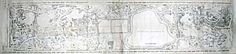
- Central Park
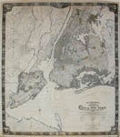
- Greater NYC Area
- LI Maps
- LI Views
- For Sale
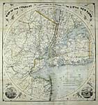
New York City Maps
19th Century
New York City Map on Rollers |
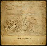
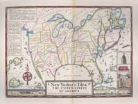
Ancient New York Map |
Two Views of the City of New York |
John B. Holmes |

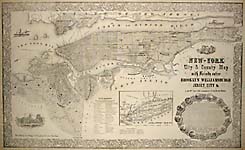
Watson and Phelps |
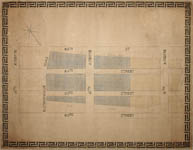
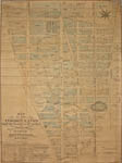
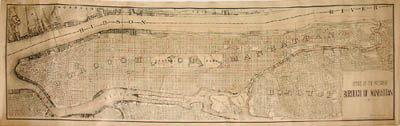
Manhattan Upper West Side Manuscript Map |
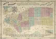
Smith Brothers |

Roger Sherman's NYC Map |
New York City Views
19th Century
See Also: Historic Buildings Archive | Landscapes Archive | Finance & Wall Street Archive
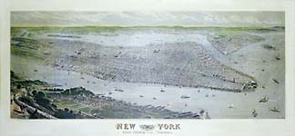
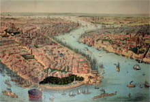
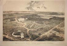
Large Centennial Bird's-eye View of New York City |
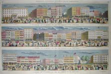
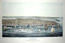
Panoramic View of Broadway |
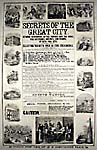
Secrets of the Great City |
Theodore S. Fay |
C.E. Lewis |

The Great East River Bridge |
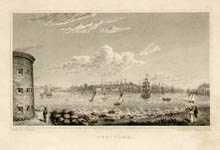
New-York |
New York City Maps
20th Century
Arthur S. Tuttle |
Louis A. Risse | 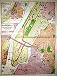
Rand McNally |

Miniature Atlas of Manhattan |
D.K. Wallingford |
Forest Hills, Queens |
Mélanie Elisabeth Leonard |
Alan Sonfist |
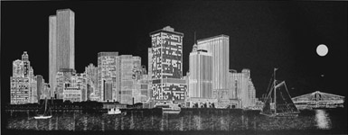
New York City Views
20th Century
See Also: Historic Buildings Archive | Landscapes Archive | Finance & Wall Street Archive
James S. Baillie |
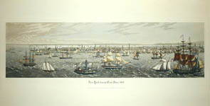
After Havell |
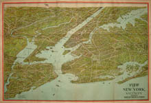
View of New York and Vicinity |
Delbart Duchein |
Central Park Maps & Views
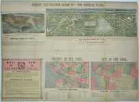
Phelps' Guide to the Central Park |
Department of Parks |

W.H. Mann |
Pierre Martel |
Maps & Views of the Greater New York Area
Westchester & Upstate (Below)
Colton & Co. |
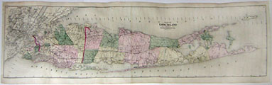
Long Island Maps
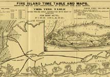
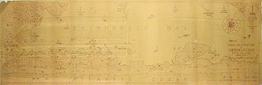
Fire Island |
G.W. & C.B. Colton |
F.H.B. Byrne/Clarence Pearson Hornung |
Edmund Blunt |

Stephen J. Voorhies |
Long Island Railroad |
Frederick W. Beers |
Walden Pell II |

Long Island Embroidery Map |

Long Island Pictorial Map |

Bridgehampton, Long Island |
Long Island Views
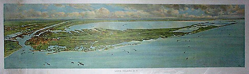
Long Island, New York |

W. Earle Andrews |
Montauk |
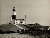
Montauk Point Lighthouse & |