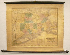
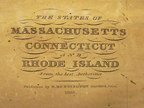
The States Of Massachusetts, Connecticut And Rhode Island and also showing part of New York from Albany to Long Island, From The Best Authorities
E. Huntington, Hartford, Connecticut: 1832
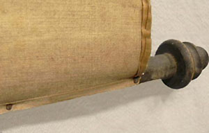
Hand-colored engraving on wooden rollers, varnished, backed on linen
22 x 25.5 inches, map sheet without rollers
Sold, please inquire as to the availability of similar items.

Map of Southern New England
Map on Rollers, 1832
Map on Rollers, 1832
This item is sold. It has been placed here in our online archives as a service for researchers and collectors.
- Please inquire as to the availability of similar items currently in stock, or use the navigation bar above to browse our site for currently available items.
- Find guidelines for the use of images from georgeglazer.com.
- To see more archived items, view our directory.
- Find information about selling your art and antiques.
 |
 |
 |
 |
 |
 |
 |
 |
 |
 |
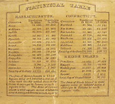
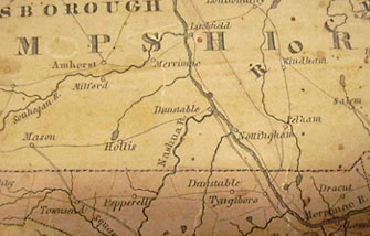
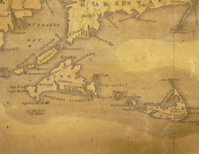
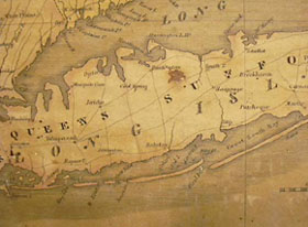
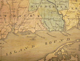
Map of the three southern New England states and parts of the surrounding states. The area depicted includes Cape Cod, Nantucket, Martha's Vineyard, Long Island and Dunstable, New Hampshire, which has since been renamed Nashua. Counties indicated in colors of green, pink, blue and yellow. A table of statistics gives the area and population density of each state, and the populations of the major cities in 1820 and 1830.
Eleazar Huntington (b. 1789) was a Hartford, Connecticut engraver active from about 1820 to 1840. His other works include a series of small American views for a school atlas, published in New York in 1828. In February 2003, two copies of the Declaration of Independence engraved by Huntington, probably to decorate a school or government building, were found in the archives of the Ipswich Historical Society in Ipswich, Massachusetts.
References:
Fielding, Mantle. Dictionary of American Painters, Sculptors and Engravers. Green Farms, Connecticut: Modern Books and Crafts, 1926, rev. ed. 1974. p. 180.
"Historical Treasures Found." Ipswich Chronicle. http://www.townonline.com/ipswich/news/local_regional/ips_newicheardje03052003.htm (13 May 2003).