Céline Salmon (artist)
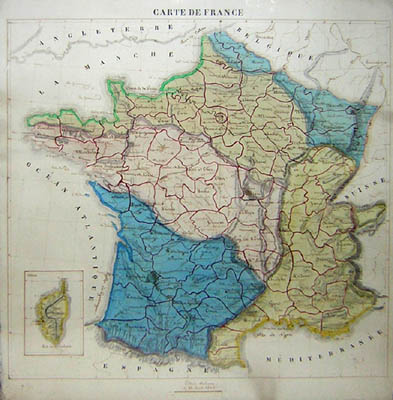
Carte de France
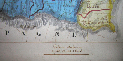
French: August 31, 1865
Signed center lower margin: Céline Salmon
le 31 Aout 1865
Pen and ink and watercolor on paper
20.25 x 18.75 inches, sight
22.25 x 20.5 inches, framed
Sold, please inquire as to the availability of similar items.

Carte de France
Original Manuscript Map, 1865
Original Manuscript Map, 1865
This item is sold. It has been placed here in our online archives as a service for researchers and collectors.
- Please inquire as to the availability of similar items currently in stock, or use the navigation bar above to browse our site for currently available items.
- Find guidelines for the use of images from georgeglazer.com.
- To see more archived items, view our directory.
- Find information about selling your art and antiques.
 |
 |
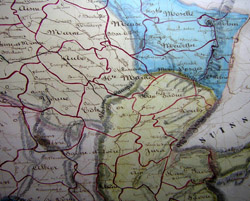 |
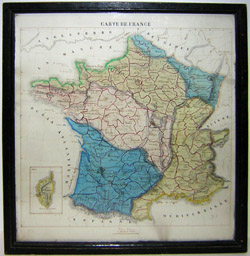

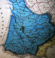
Original map of France hand drawn and lettered in brown ink, with the departments (governmental units) outlined in red, and the major regions shaded in watercolor, in shade of blue, pink and yellow. A small inset map of the island of Corsica appears lower left. Apparently in a 19th century ebonized frame with original backing.
The map is signed by Céline Salmon, presumably a French student made by as part of her education. It is particularly accomplished, with fine calligraphic lettering and vibrant coloring. In 19th century European and American schools and private education, it was common for female students to practice geography and develop artistic skills by drawing and painting maps as well as embroidering them (generally in silk). English students frequently made maps of England or the United Kingdom, and French students made maps of France. Also popular were maps of the world.