John Andrews
A New Map Of France From Astronomical Observations, Divided With The New Division
According To The Decrees Of the National Assembly Into 83 Departments And Subdivided
into 537 Districts, On Which Are Delineated All The Post And Direct Cross Roads With
the Distances In Post From Town To Town
London: 1792
Hand-colored engraving on rollers
24.5 x 27.5 inches
Sold, please inquire as to the availability of similar items.

A New Map of France
John Andrews, 1792
John Andrews, 1792
This item is sold. It has been placed here in our online archives as a service for researchers and collectors.
- Please inquire as to the availability of similar items currently in stock, or use the navigation bar above to browse our site for currently available items.
- Find guidelines for the use of images from georgeglazer.com.
- To see more archived items, view our directory.
- Find information about selling your art and antiques.
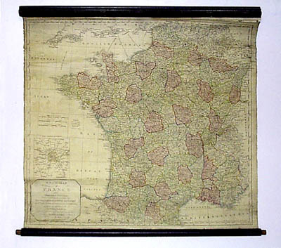
An unusually early wall map of France on rollers in full handcoloring, well detailed with map notes, cities, towns, rivers, mountains, ports, islands, etc. Also contain an inset of the environs of Paris.